WorldmapPDF
Large map of Asia
View political and physical asia maps in HD and in different formats such as JPG, PDF, PNG. Maps in PNG format are often of better quality.


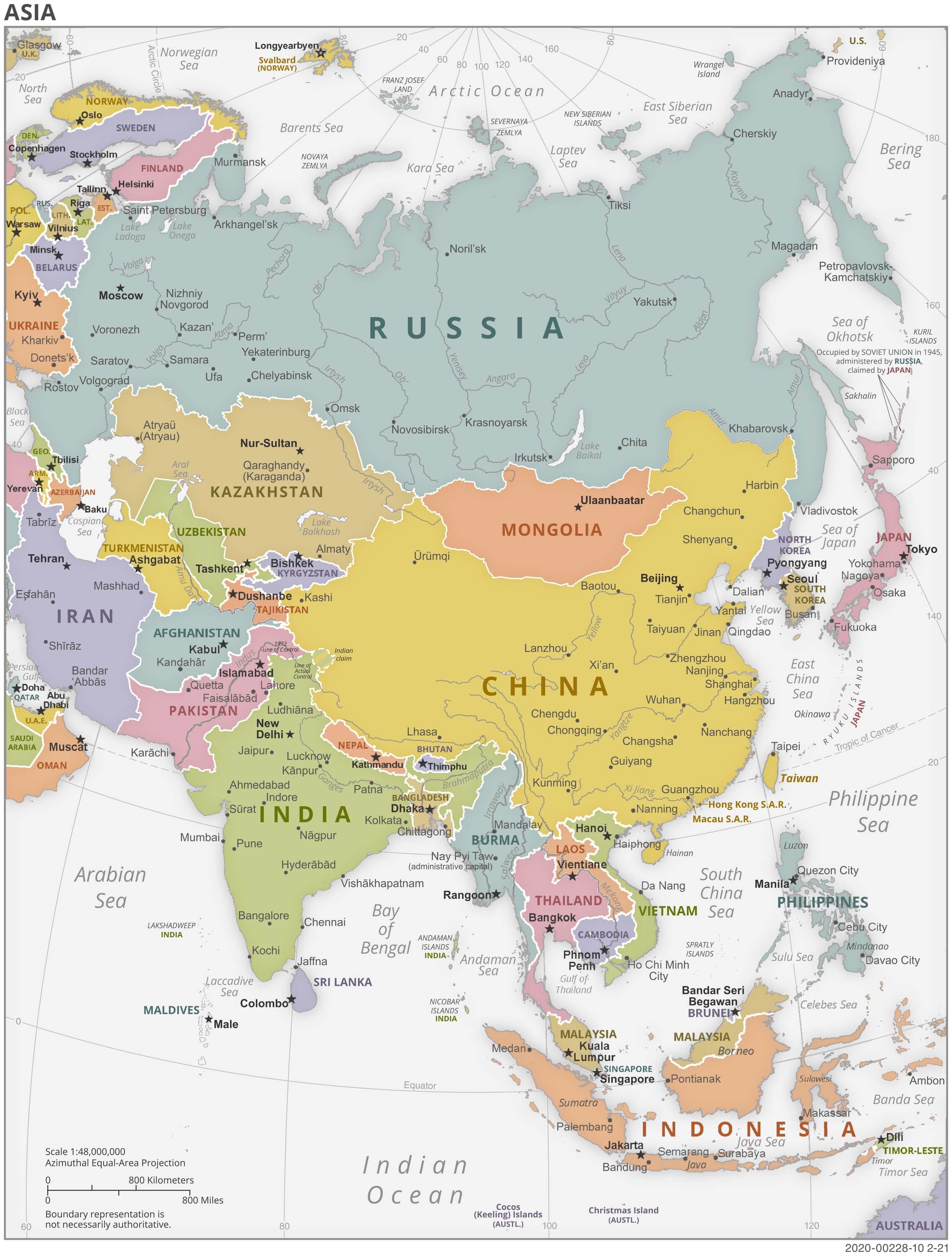
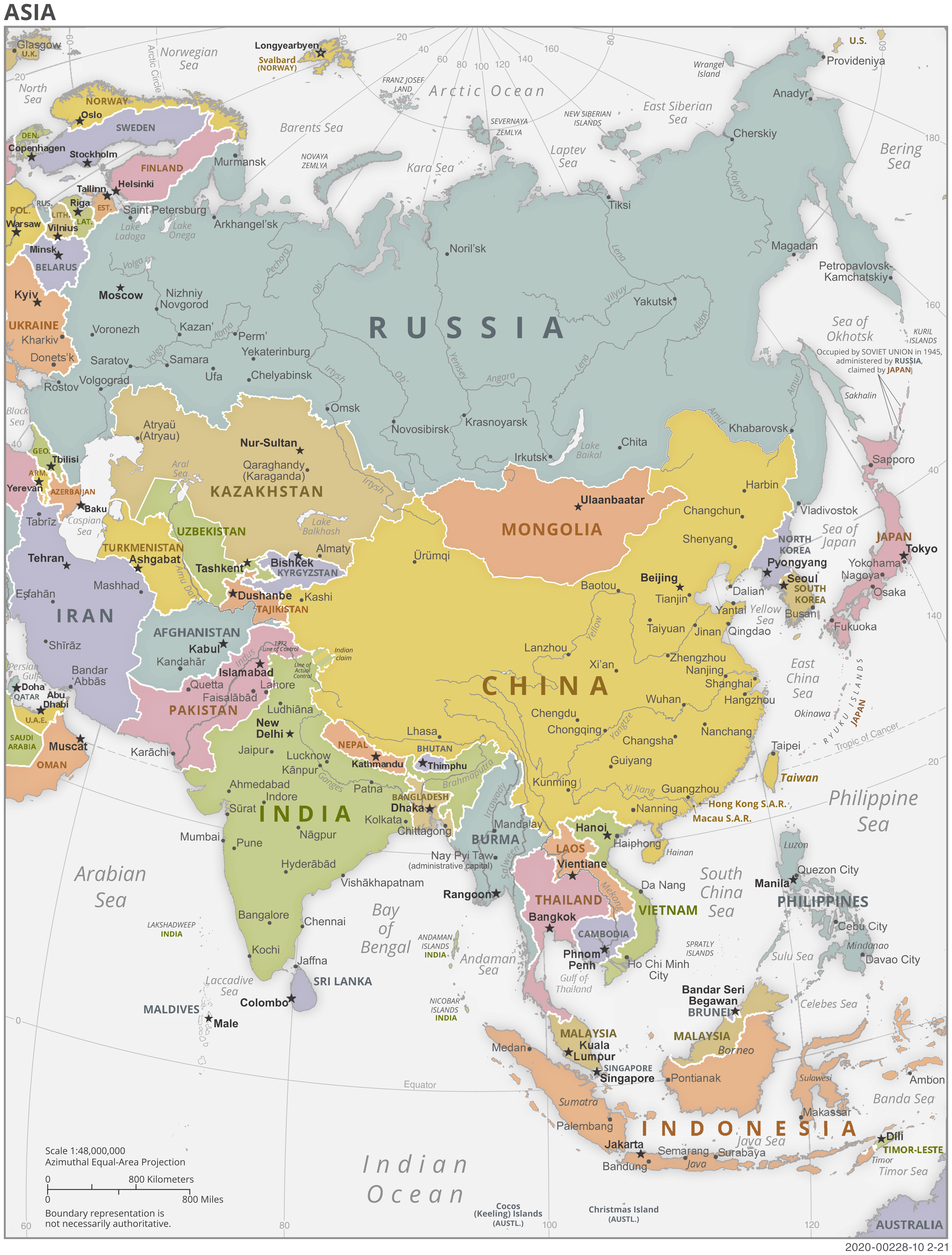
Political map of Asia

Download: JPG (607 x 800 pixels) | JPG (2275 x 3000 pixels) | JPG (4950 x 6527 pixels) | PNG | PDF
Description: Large political map of Asia with colored countries, capitals, major cities and rivers.
License: Royalty free
Author: US Government, Central Intelligence Agency
Source file: The World Factbook 2020 Central Intelligence Agency.
Description: Large political map of Asia with colored countries, capitals, major cities and rivers.
License: Royalty free
Author: US Government, Central Intelligence Agency
Source file: The World Factbook 2020 Central Intelligence Agency.
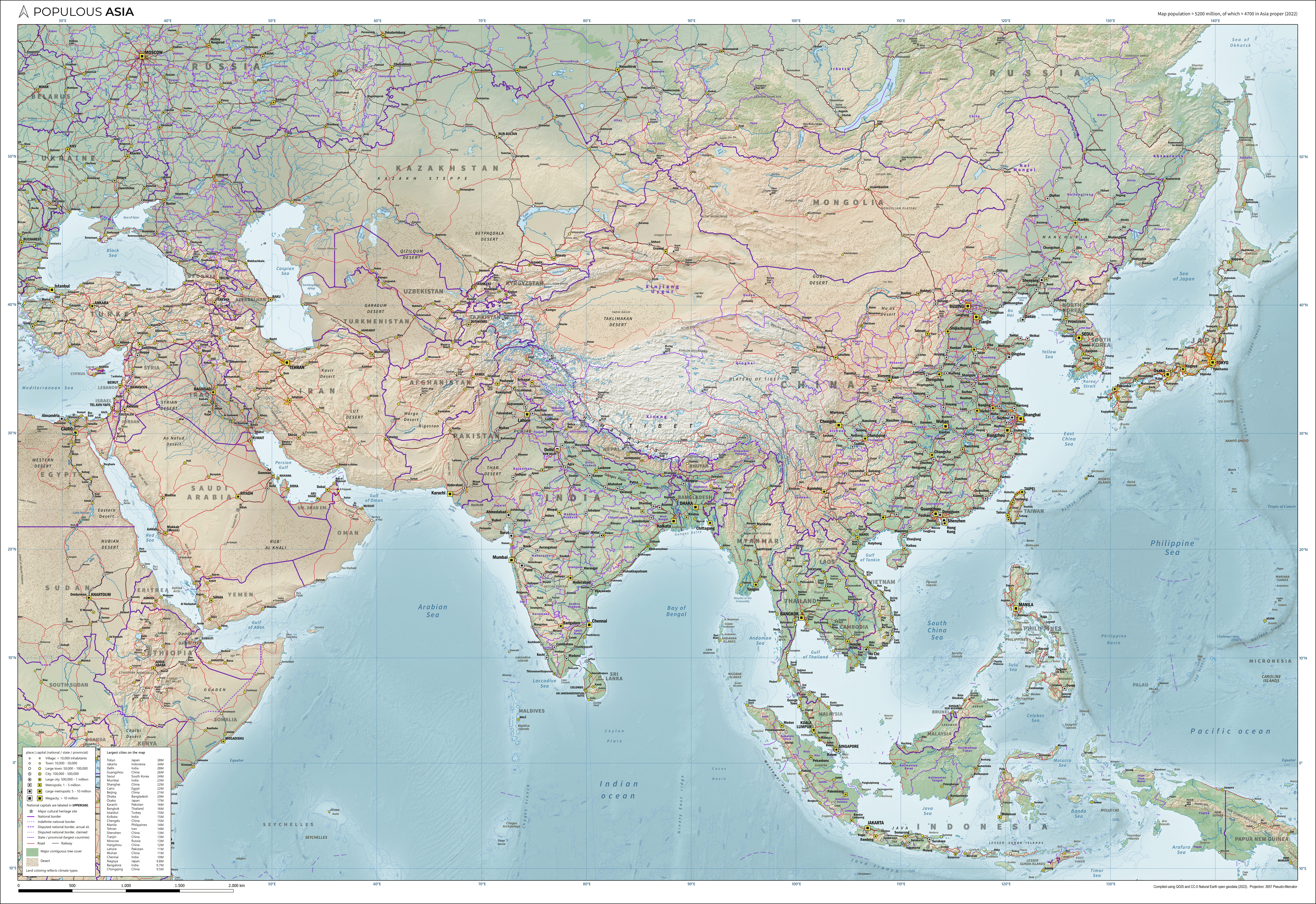
Detailed Asia map

Download: JPG (800 x 550 pixels) | JPG (3000 x 2061 pixels) | JPG (6989 x 4802 pixels) | PNG | PDF
Description: Large detailed map of Asia with cities, their size, roads and railways. The map also shows the capitals of each country, rivers, forests, deserts and major cultural heritage sites.
License: CC BY-SA 4.0
Author: Janwillemvanaalst
Source file: Wikipedia.org (view)
Description: Large detailed map of Asia with cities, their size, roads and railways. The map also shows the capitals of each country, rivers, forests, deserts and major cultural heritage sites.
License: CC BY-SA 4.0
Author: Janwillemvanaalst
Source file: Wikipedia.org (view)
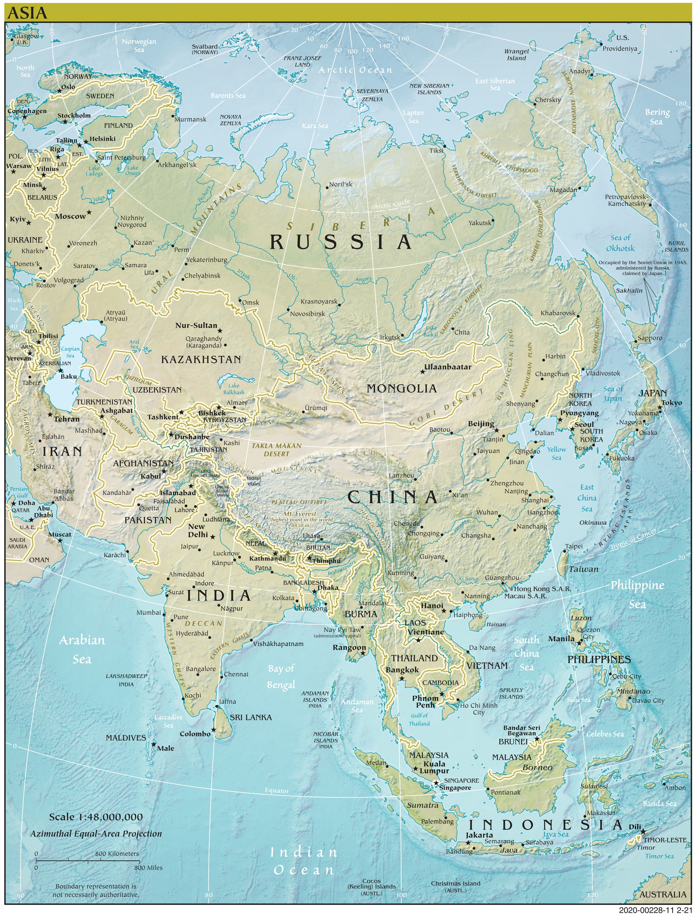
Physical map of Asia

Download: JPG (607 x 800 pixels) | JPG (2275 x 3000 pixels) | JPG (4960 x 6542 pixels) | PNG | PDF
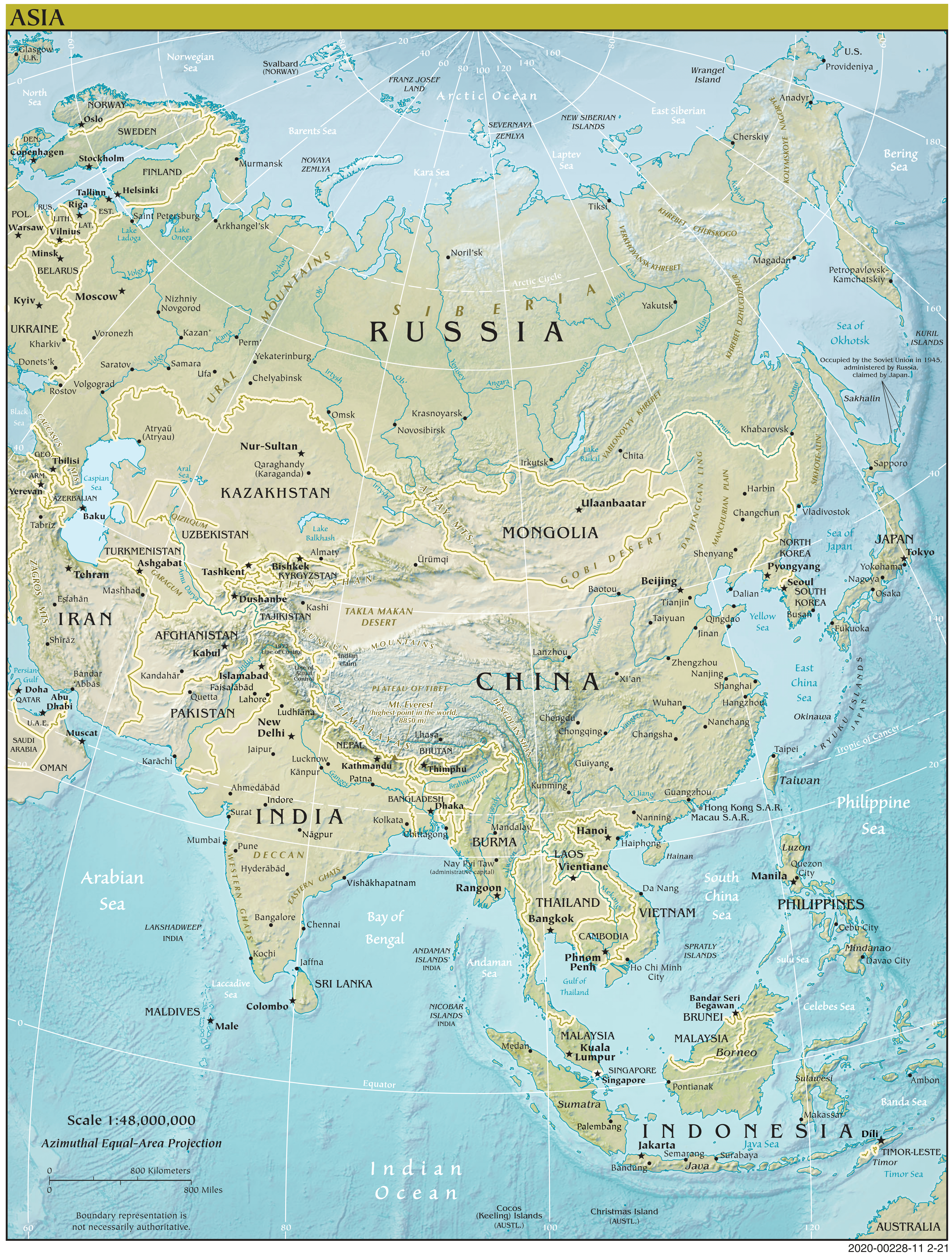
Description: Physical map of Asia with countries, capitals and cities. The map also shows the relief with rivers, lakes, mountains, plains and plateaus.
License: Royalty free
Author: US Government, Central Intelligence Agency
Source file: The World Factbook 2020 Central Intelligence Agency.
Description: Physical map of Asia with countries, capitals and cities. The map also shows the relief with rivers, lakes, mountains, plains and plateaus.
License: Royalty free
Author: US Government, Central Intelligence Agency
Source file: The World Factbook 2020 Central Intelligence Agency.