WorldmapPDF
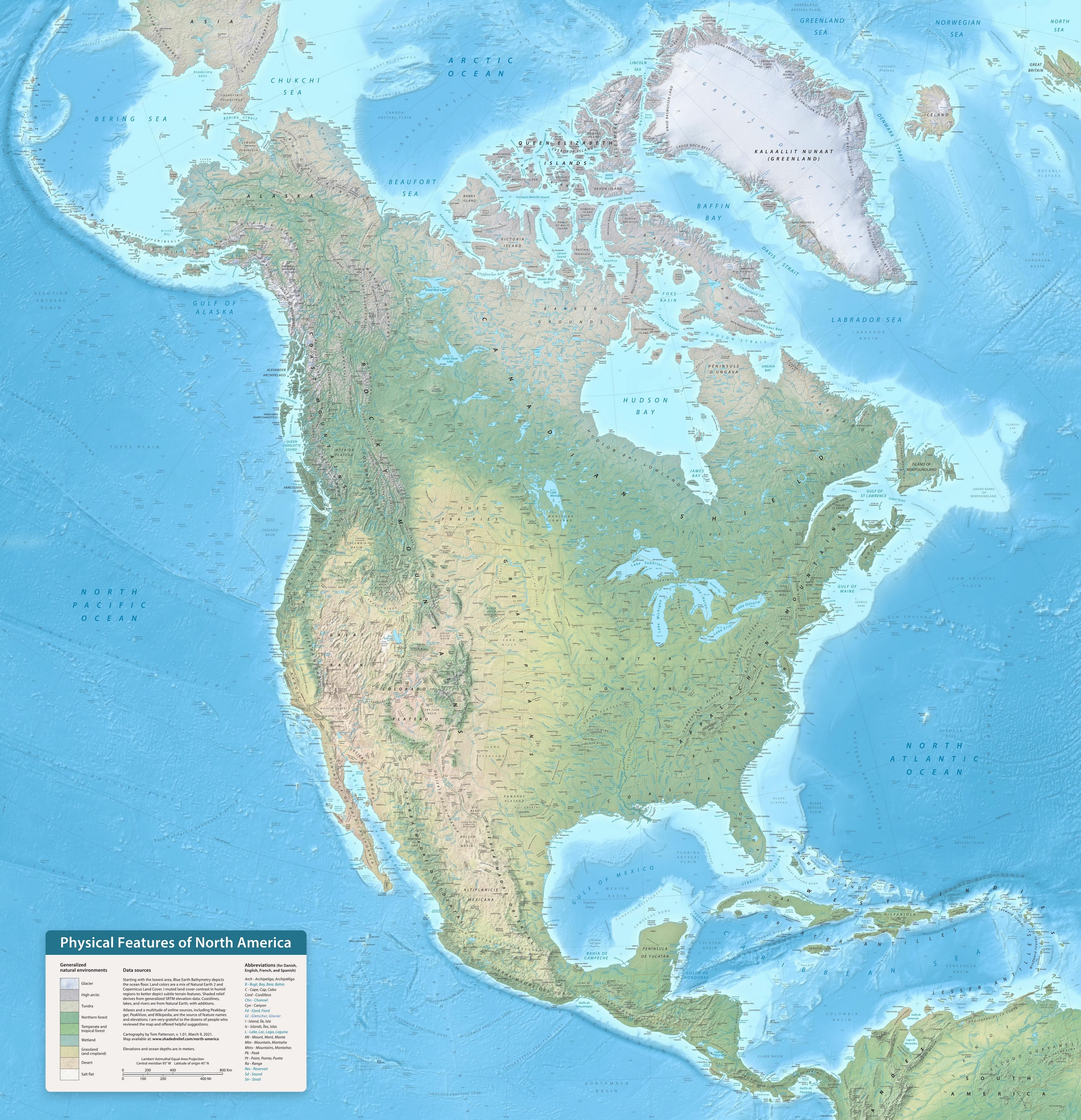
Large physical map of America
View world maps and continents in HD and in different formats such as JPG, PDF, PNG. Maps in PNG format are often of better quality.


Physical map of America

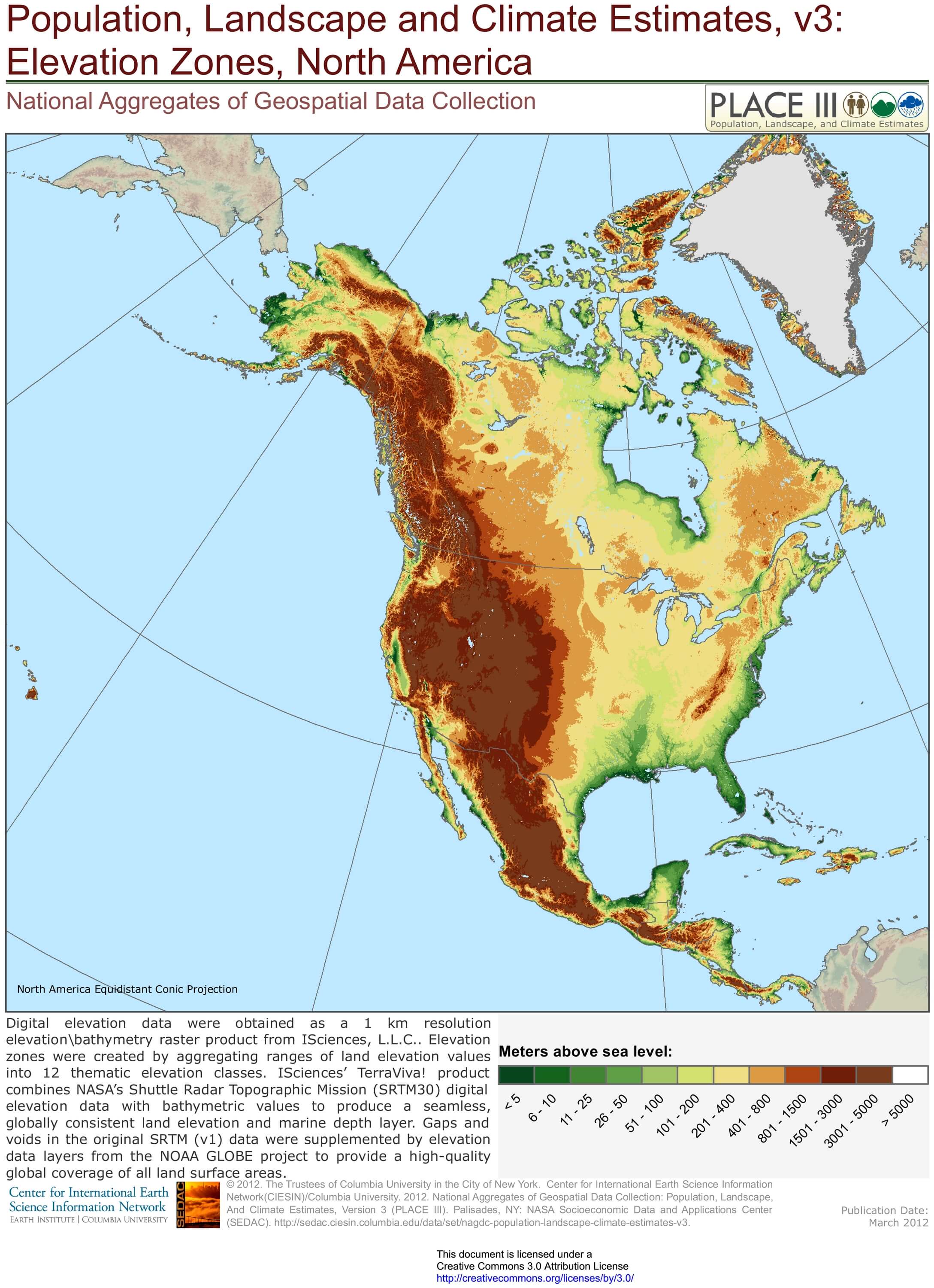
Map of North America with elevation zones

Download: JPG (580 x 800 pixels) | JPG (2177 x 3000 pixels) | JPG (4552 x 6274 pixels) | PNG | PDF
Description: Large map of North America with relief and altitude in meters. Accurate elevation.
License: CC BY 3.0
Author: Center for International Earth Science Information Network (CIESIN)
Source file: Columbia University of New York (SEDAC)
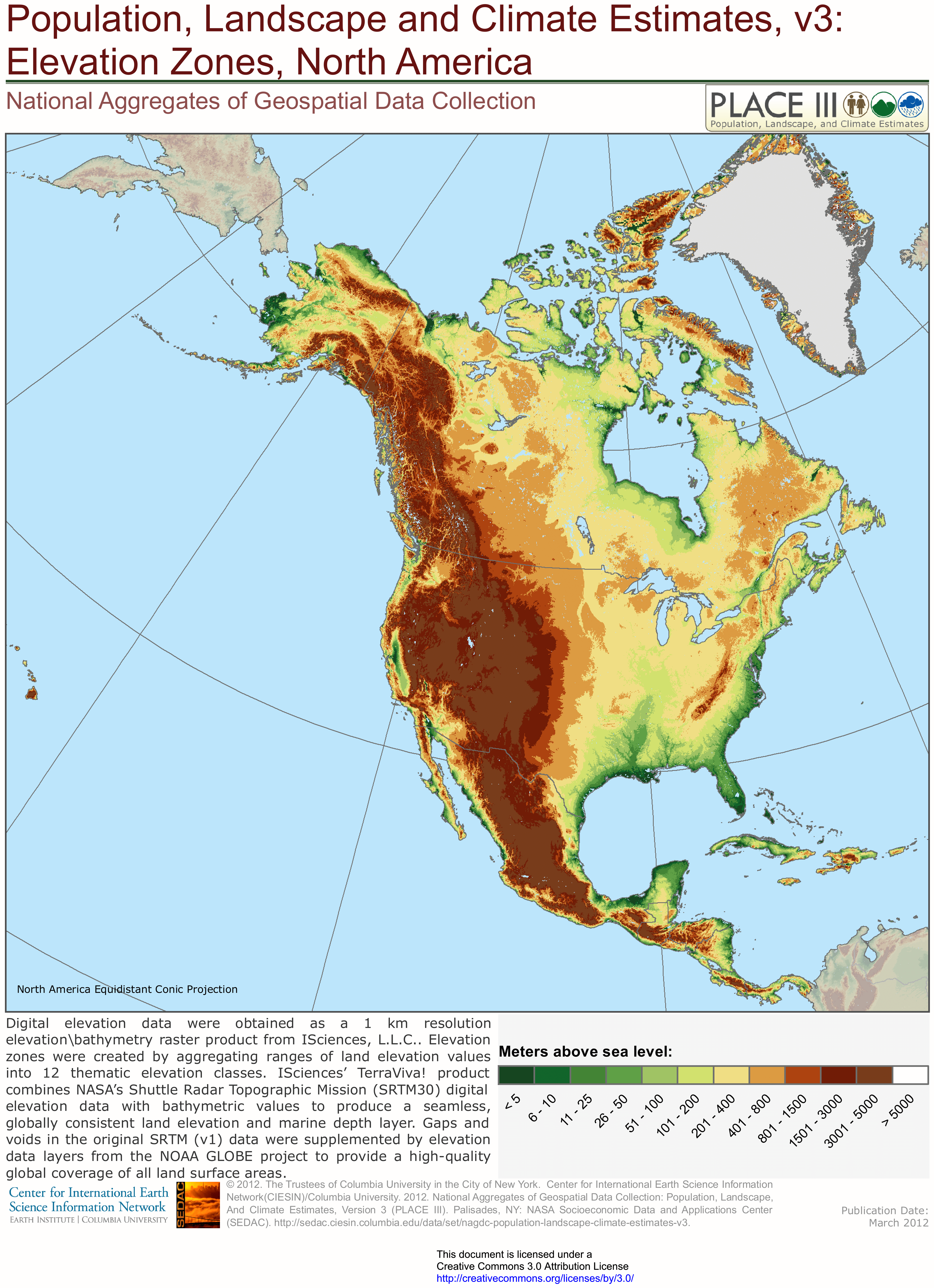
Description: Large map of North America with relief and altitude in meters. Accurate elevation.
License: CC BY 3.0
Author: Center for International Earth Science Information Network (CIESIN)
Source file: Columbia University of New York (SEDAC)
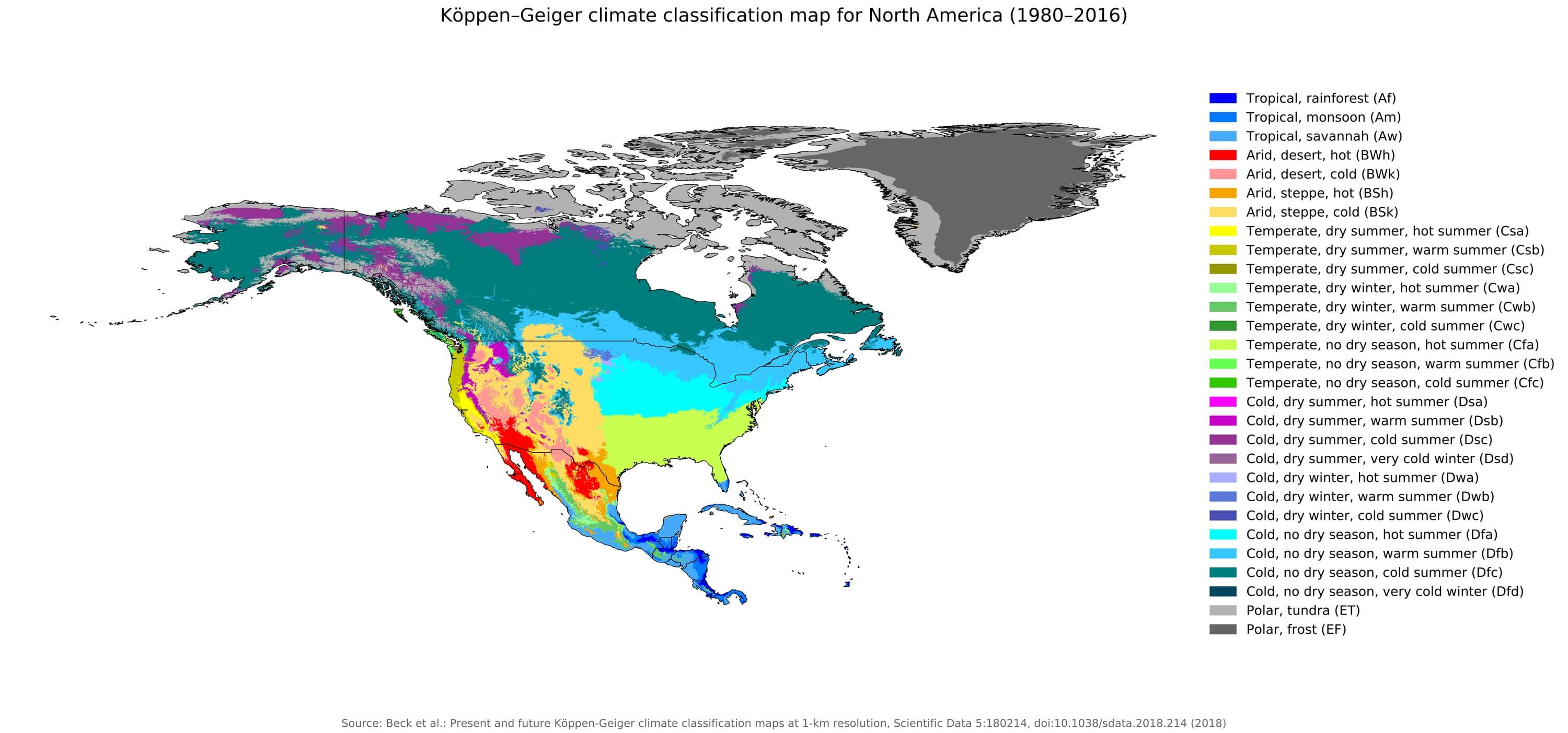
Climate map of America

Download: JPG (800 x 375 pixels) | JPG (3000 x 1404 pixels) | JPG (7064 x 3307 pixels) | PNG | PDF | SVG
Description: Map of North American climates according to the Köppen–Geiger classification.
License: CC BY 4.0
Authors: Beck, H.E., Zimmermann, N. E., McVicar, T. R., Vergopolan, N., Berg, A., & Wood, E. F.
Source file: Wikipedia.org (view)
Description: Map of North American climates according to the Köppen–Geiger classification.
License: CC BY 4.0
Authors: Beck, H.E., Zimmermann, N. E., McVicar, T. R., Vergopolan, N., Berg, A., & Wood, E. F.
Source file: Wikipedia.org (view)