WorldmapPDF
Large detailed Europe map
View world maps and continents in HD and in different formats such as JPG, PDF, PNG. Maps in PNG format are often of better quality.


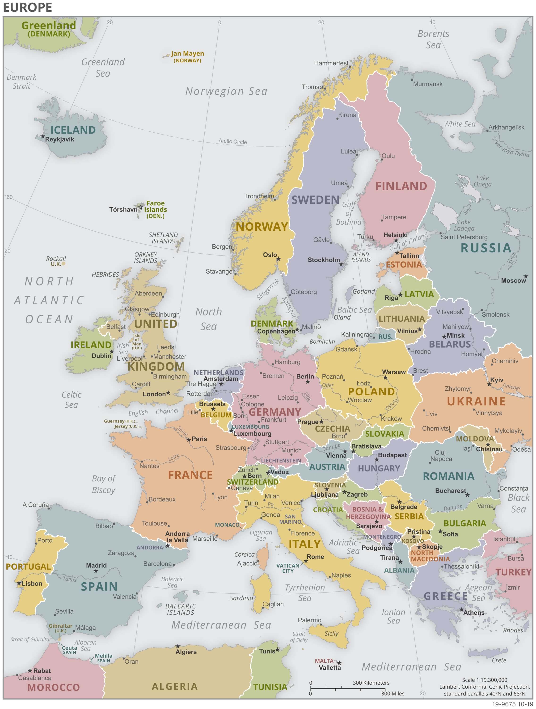
Political Europe map

Download: JPG (605 x 800 pixels) | JPG (2271 x 3000 pixels) | JPG (4240 x 5602 pixels) | PNG | PDF
Description: Political map of Europe with countries in color, capitals, major cities and rivers.
License: Royalty free
Author: US Government, Central Intelligence Agency
Source file: The World Factbook 2020 Central Intelligence Agency.
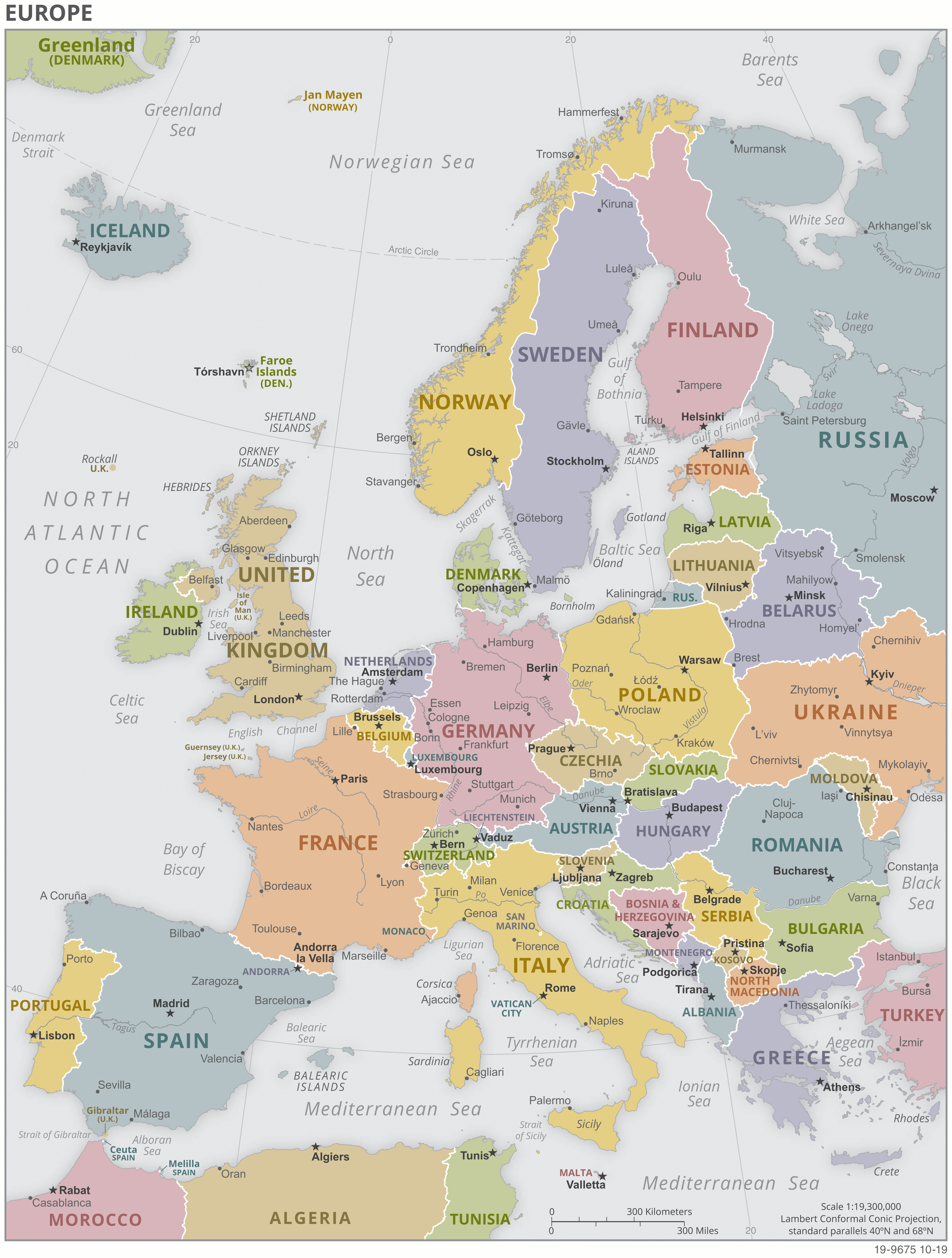
Description: Political map of Europe with countries in color, capitals, major cities and rivers.
License: Royalty free
Author: US Government, Central Intelligence Agency
Source file: The World Factbook 2020 Central Intelligence Agency.
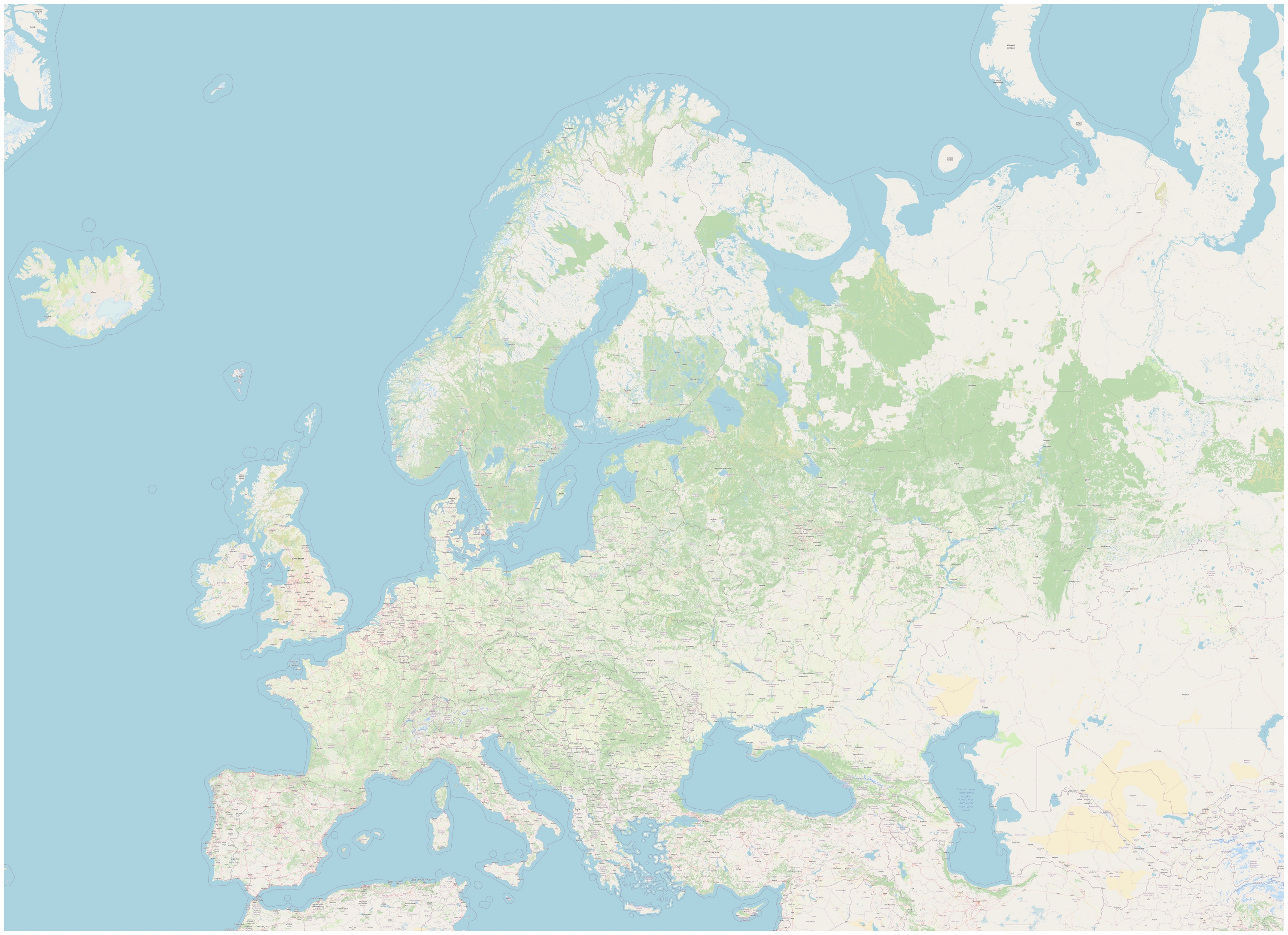
Detailed Europe map

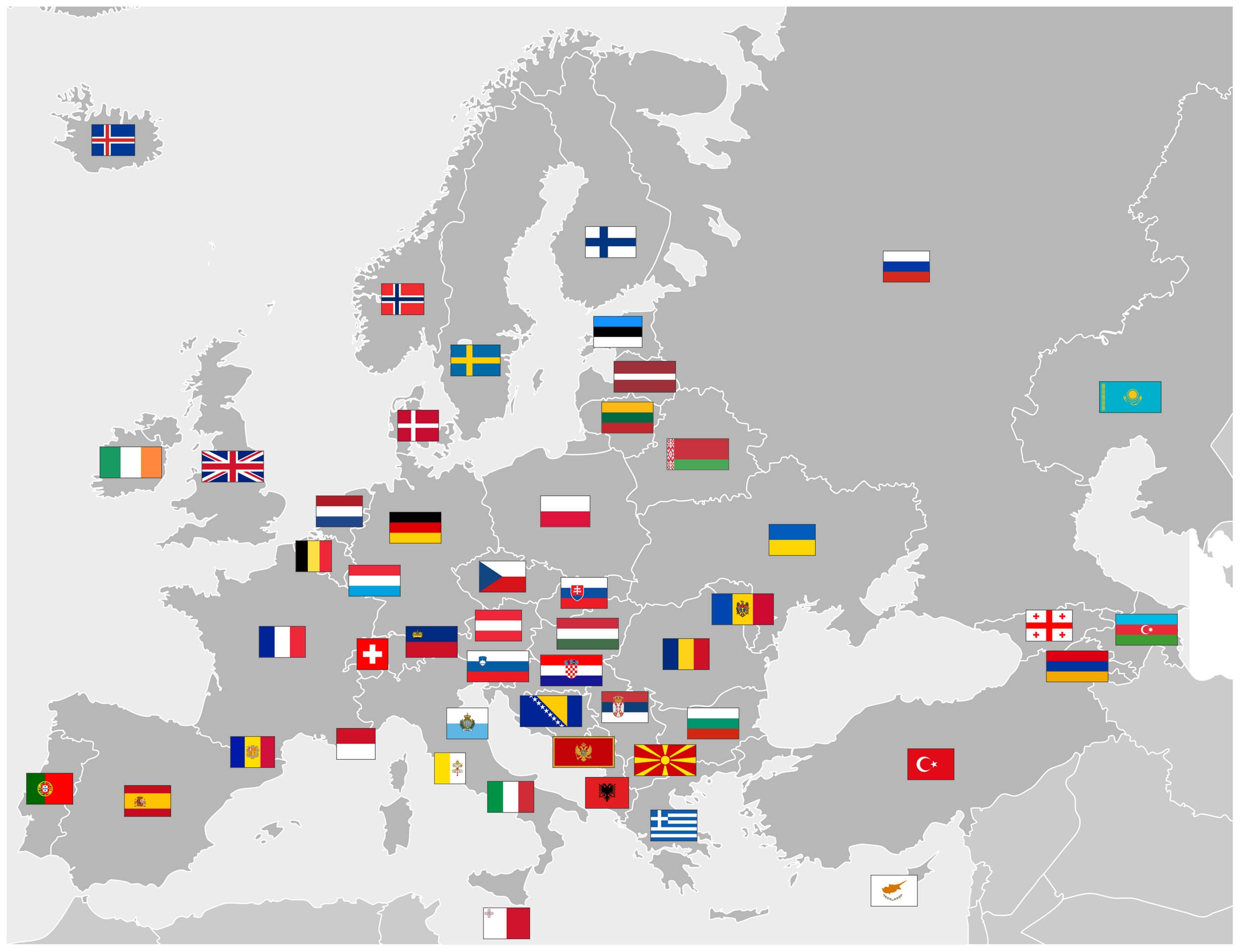
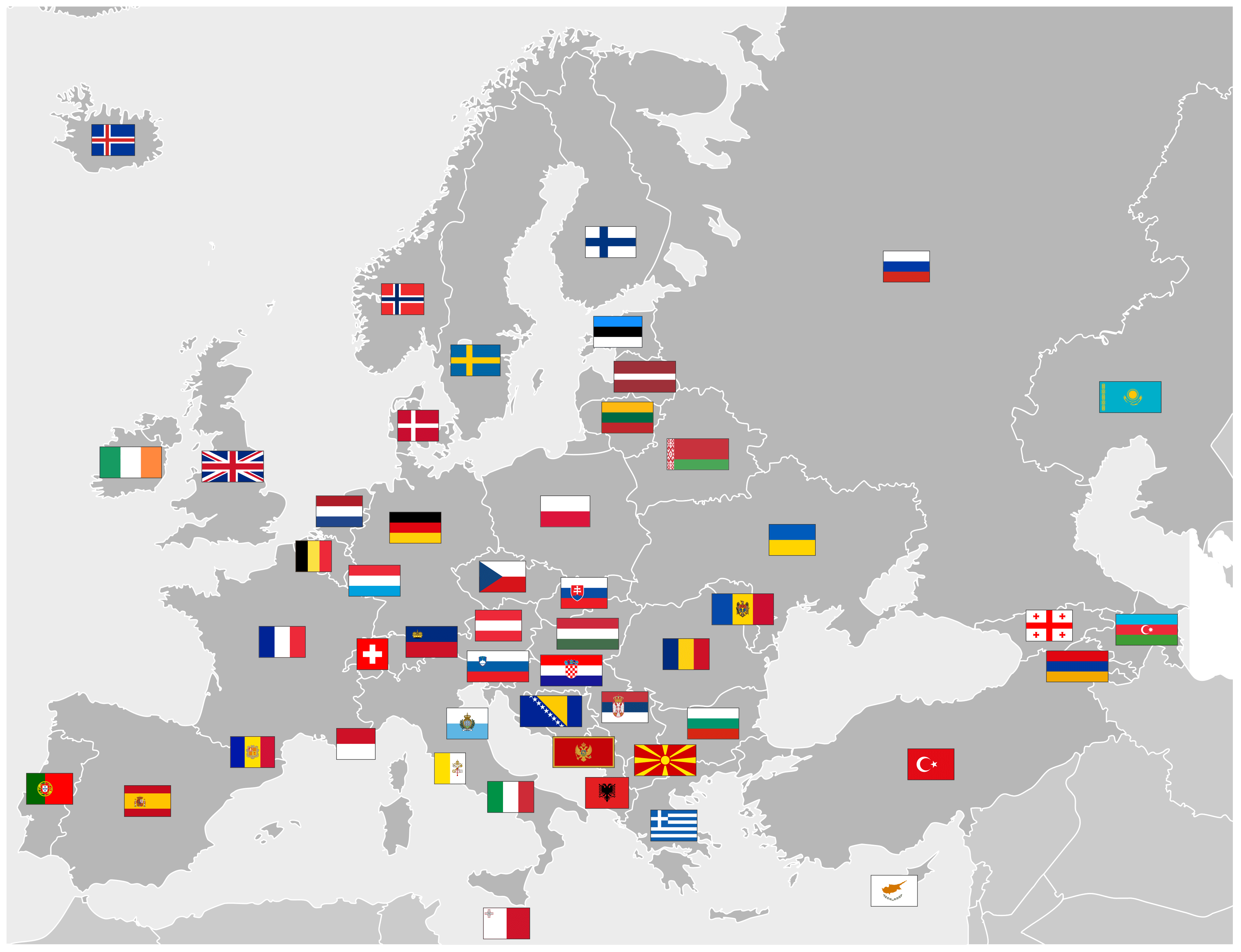
Map of Europe with flags
