WorldmapPDF
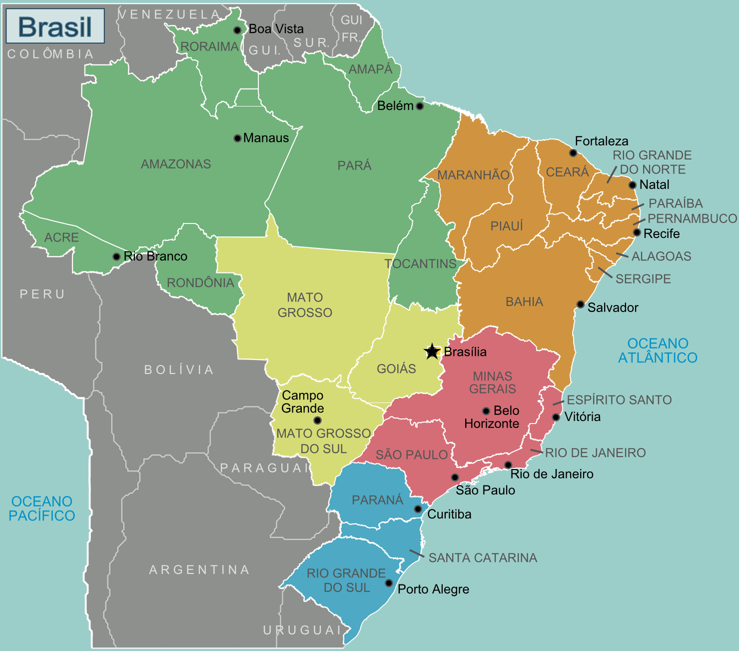
Map of Brazil with regions and cities
View detailed maps of Brazil in HD and in different formats such as JPG, PDF, PNG. Maps in PNG format are often of better quality.


Map of the regions of Brazil

Download: JPG (800 x 704 pixels) | JPG (1479 x 1302 pixels) | PNG
Description: Map of Brazil with colored regions, cities and capital.
License: CC BY-SA 3.0
Author: Stefan Ertmann and João Felipe, amendments by Texugo and Joelf
Source file: Wikimedia Commons (view)
Description: Map of Brazil with colored regions, cities and capital.
License: CC BY-SA 3.0
Author: Stefan Ertmann and João Felipe, amendments by Texugo and Joelf
Source file: Wikimedia Commons (view)
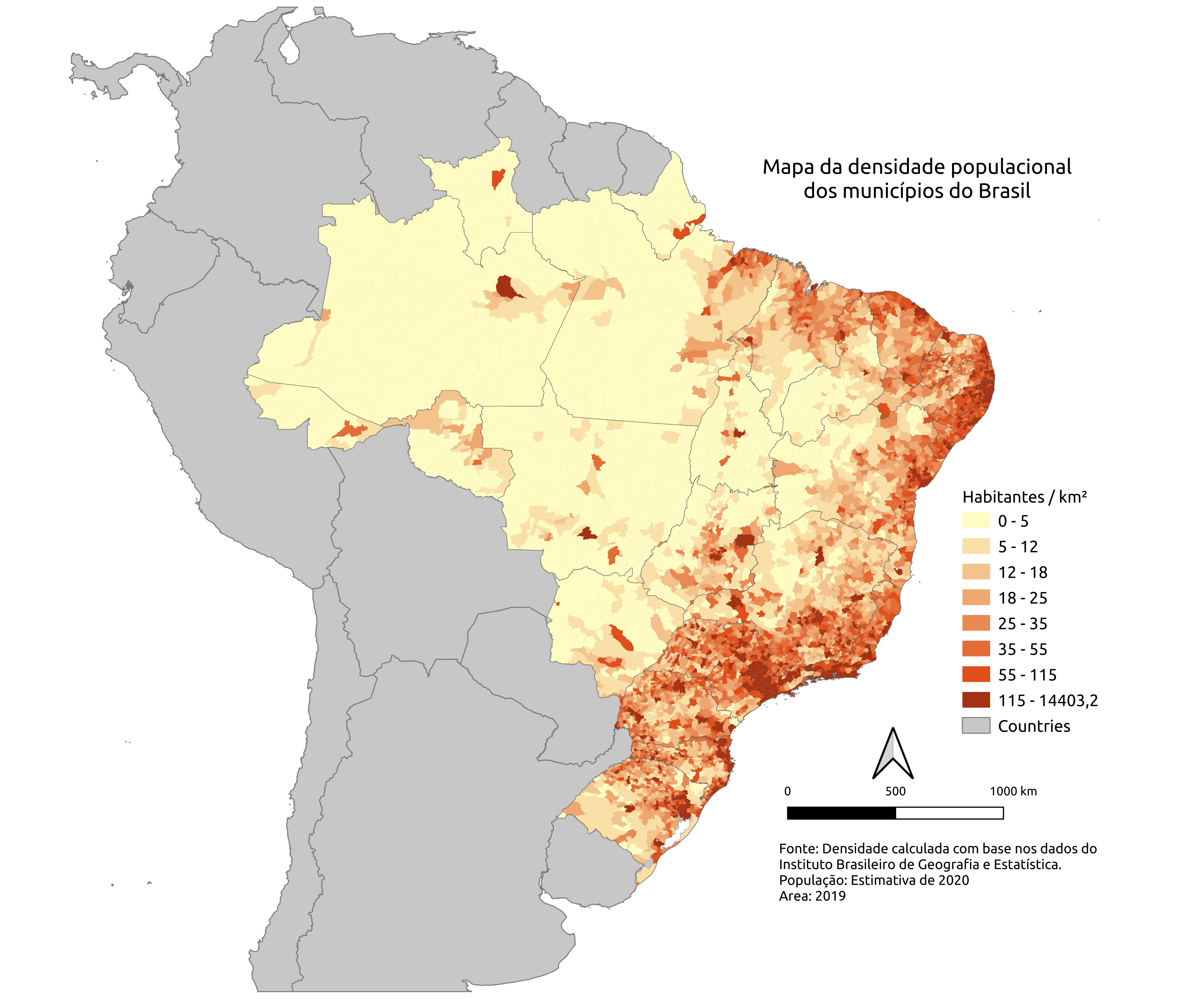
Map of Brazil with population density

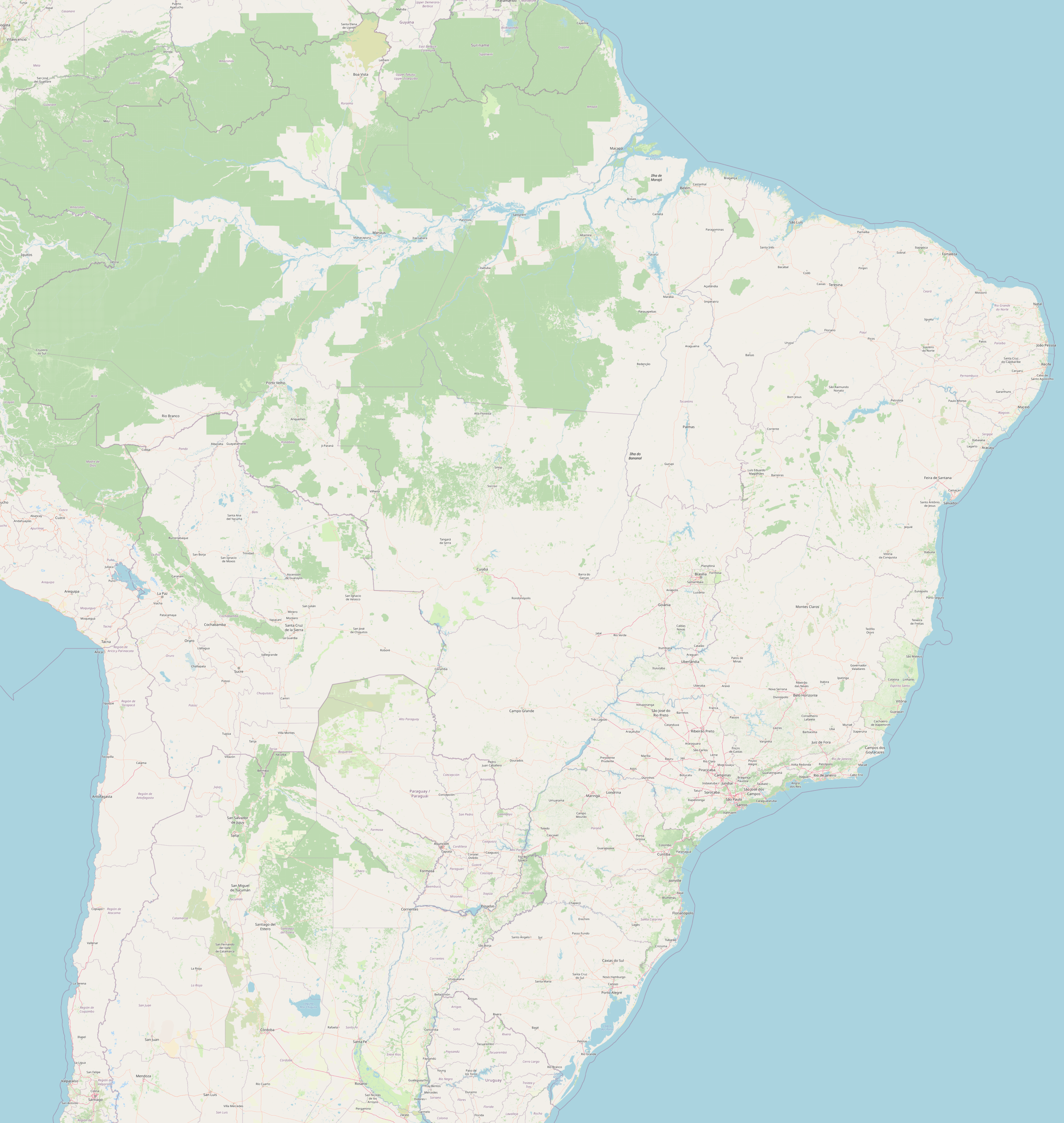
Detailed map of Brazil
