WorldmapPDF
Map of India with cities and roads
View detailed maps of India in HD and in different formats such as JPG, PDF, PNG. Maps in PNG format are often of better quality.


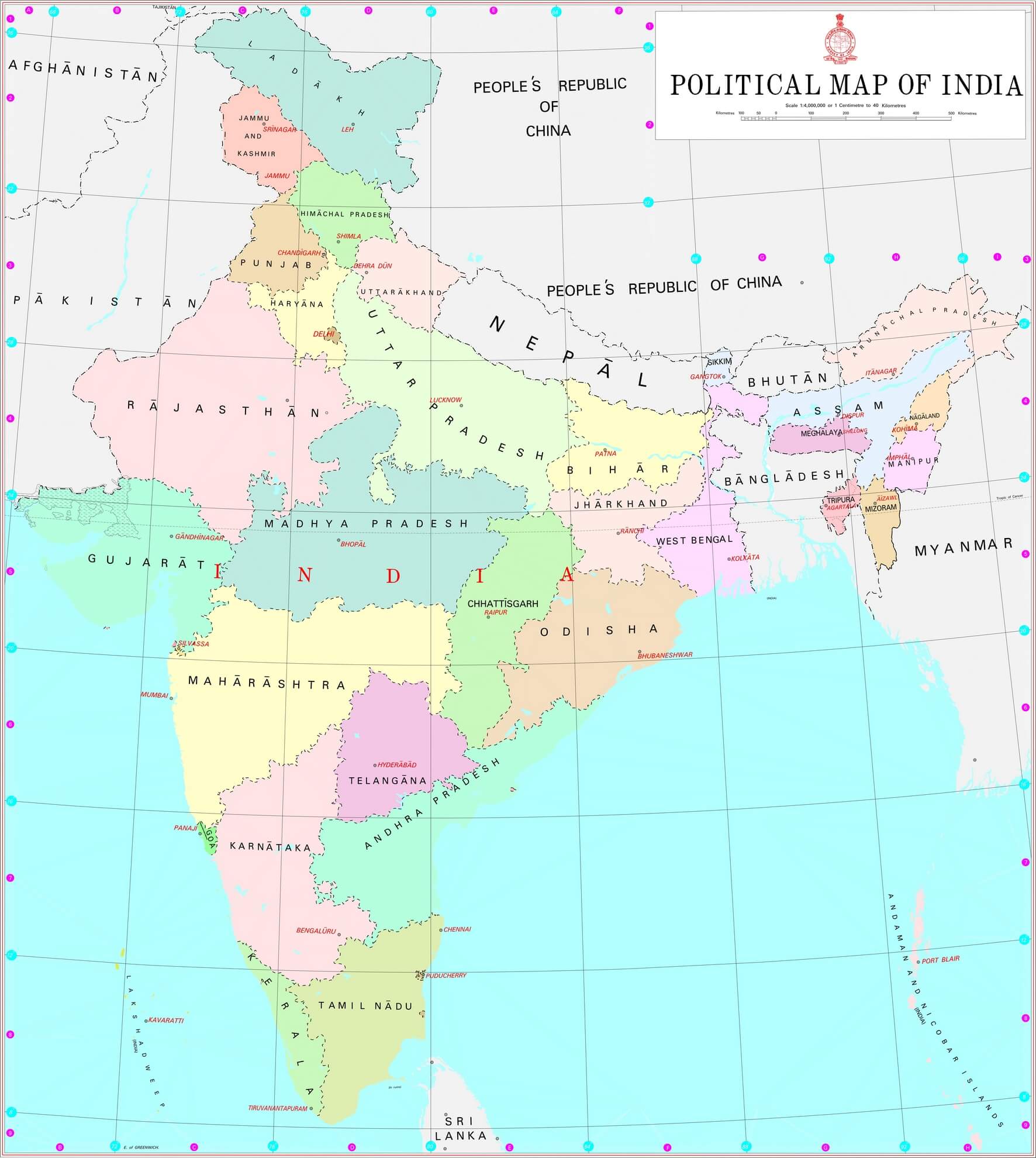
Administrative map of India with regions

Download: JPG (716 x 800 pixels) | JPG (1772 x 1980 pixels) | JPG (8735 x 9759 pixels)
Description: Political map of India with regions in color and the capitals of each region.
License: Government Open Data License - India (GODL)
Author: Ministry of Home Affairs, Government of India
Source file: Wikimedia Commons (view)
Description: Political map of India with regions in color and the capitals of each region.
License: Government Open Data License - India (GODL)
Author: Ministry of Home Affairs, Government of India
Source file: Wikimedia Commons (view)
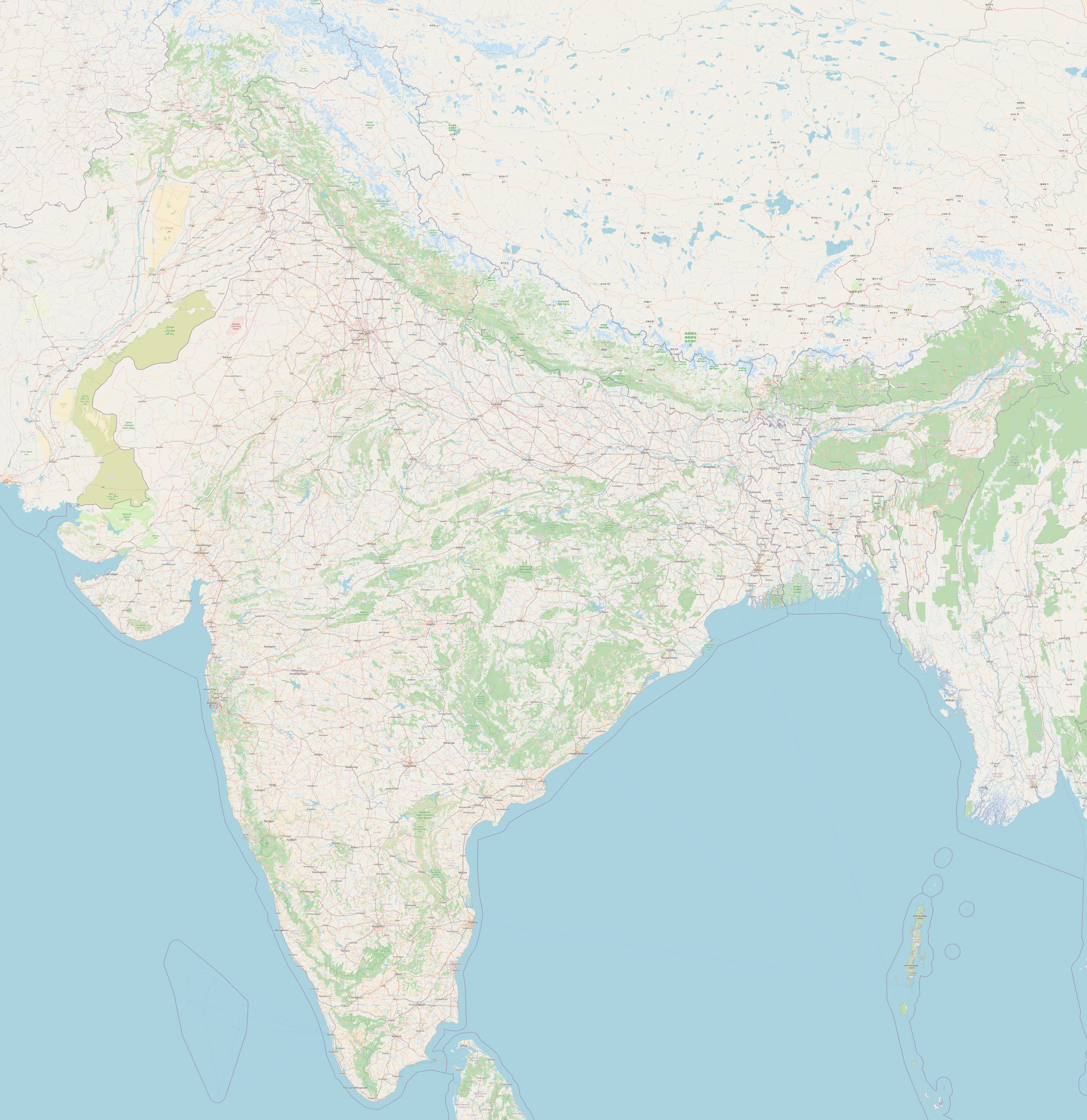
Large detailed map of India

Download: JPG (776 x 800 pixels) | JPG (4799 x 4945 pixels) | PNG (4799 x 4945 pixels)
Description: Large detailed map of India with cities, towns, roads and rivers.
License: Open data (ODbl)
Author: OpenStreetMap and contributors
Source file: OpenStreetMap
Description: Large detailed map of India with cities, towns, roads and rivers.
License: Open data (ODbl)
Author: OpenStreetMap and contributors
Source file: OpenStreetMap
Population density map of India
