WorldmapPDF
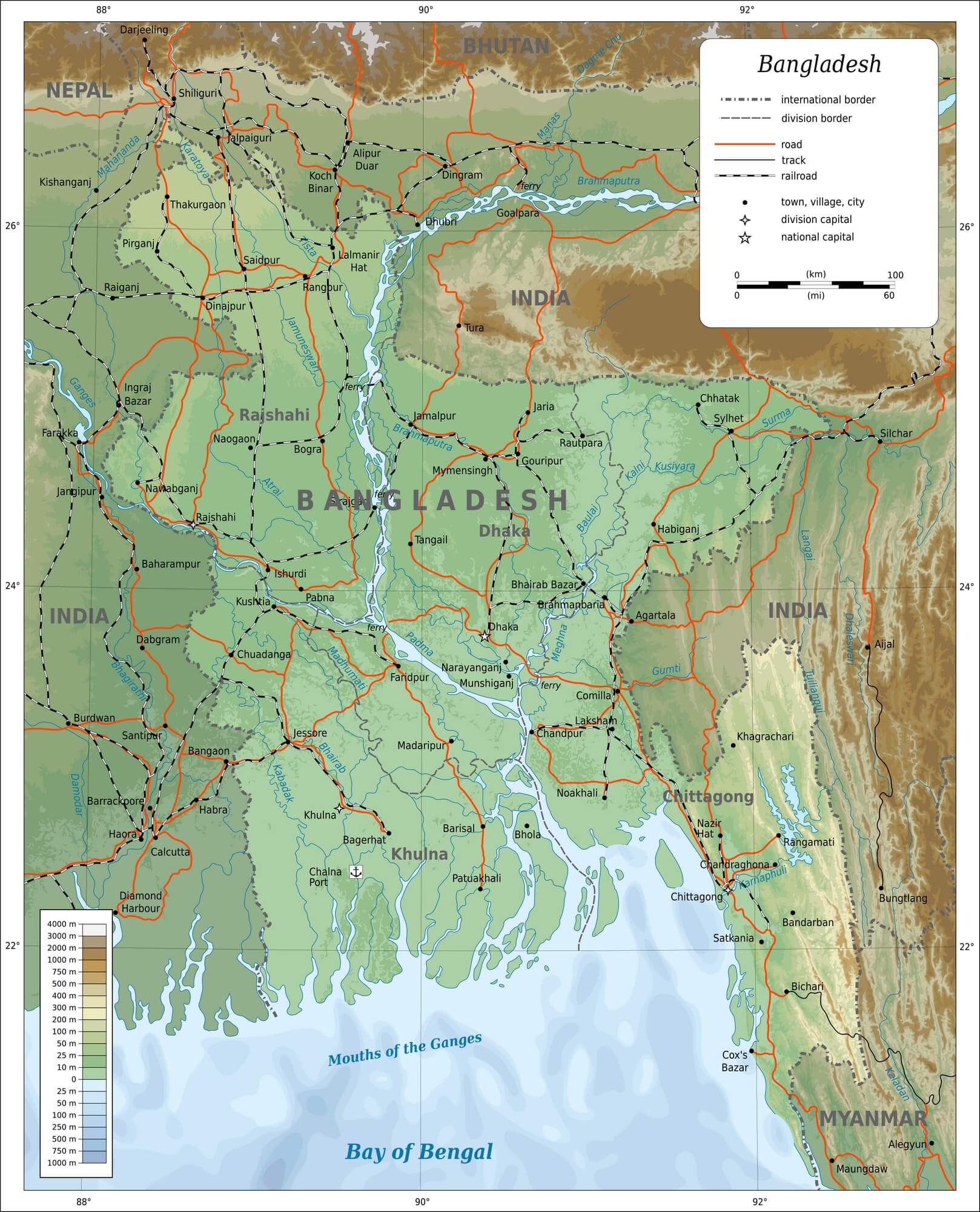
Large map of Bangladesh with cities
View detailed maps of Bangladesh in HD and in different formats such as JPG, PDF, PNG. Maps in PNG format are often of better quality.


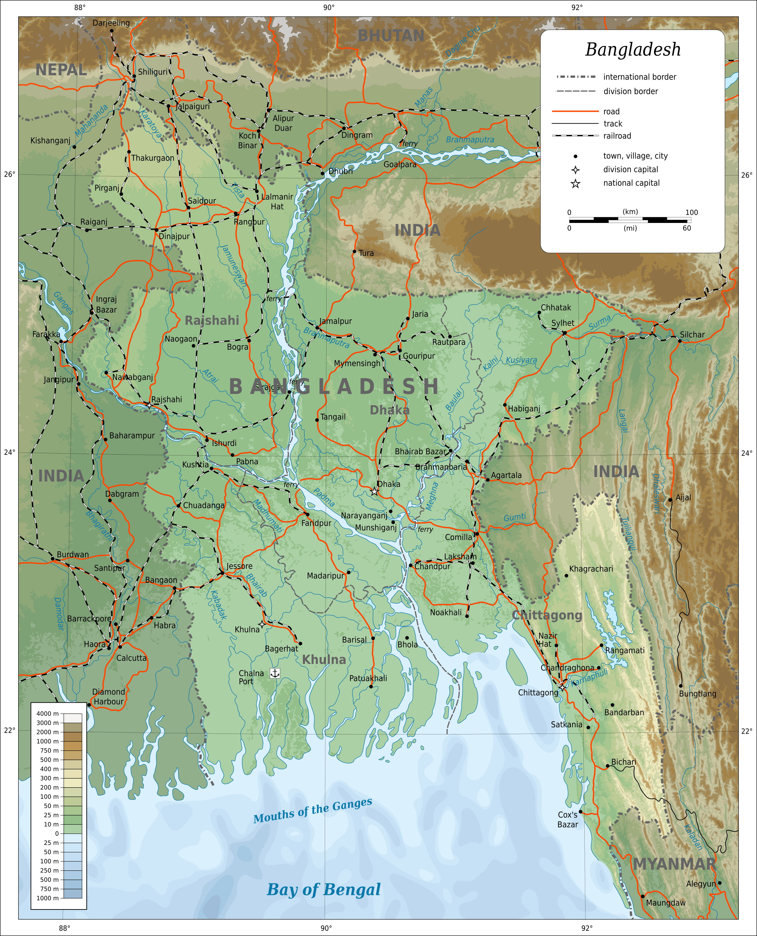
Large map of Bangladesh with roads

Download: JPG (647 x 800 pixels) | JPG (1618 x 2000 pixels) | JPG (2622 x 3241 pixels) | PNG (647 x 800 pixels) | PNG (1618 x 2000 pixels) | PNG (2622 x 3241 pixels) | PDF | SVG
Description: Large map of Bangladesh with cities, roads, railways, rivers and elevation in meters.
License: CC BY 3.0
Author: Oona Räisänen (Mysid)
Source file: Wikipedia.org (view)
Description: Large map of Bangladesh with cities, roads, railways, rivers and elevation in meters.
License: CC BY 3.0
Author: Oona Räisänen (Mysid)
Source file: Wikipedia.org (view)
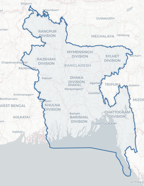
Simple map of Bangladesh

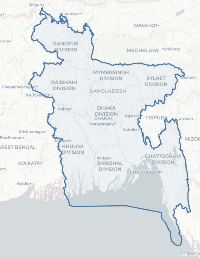
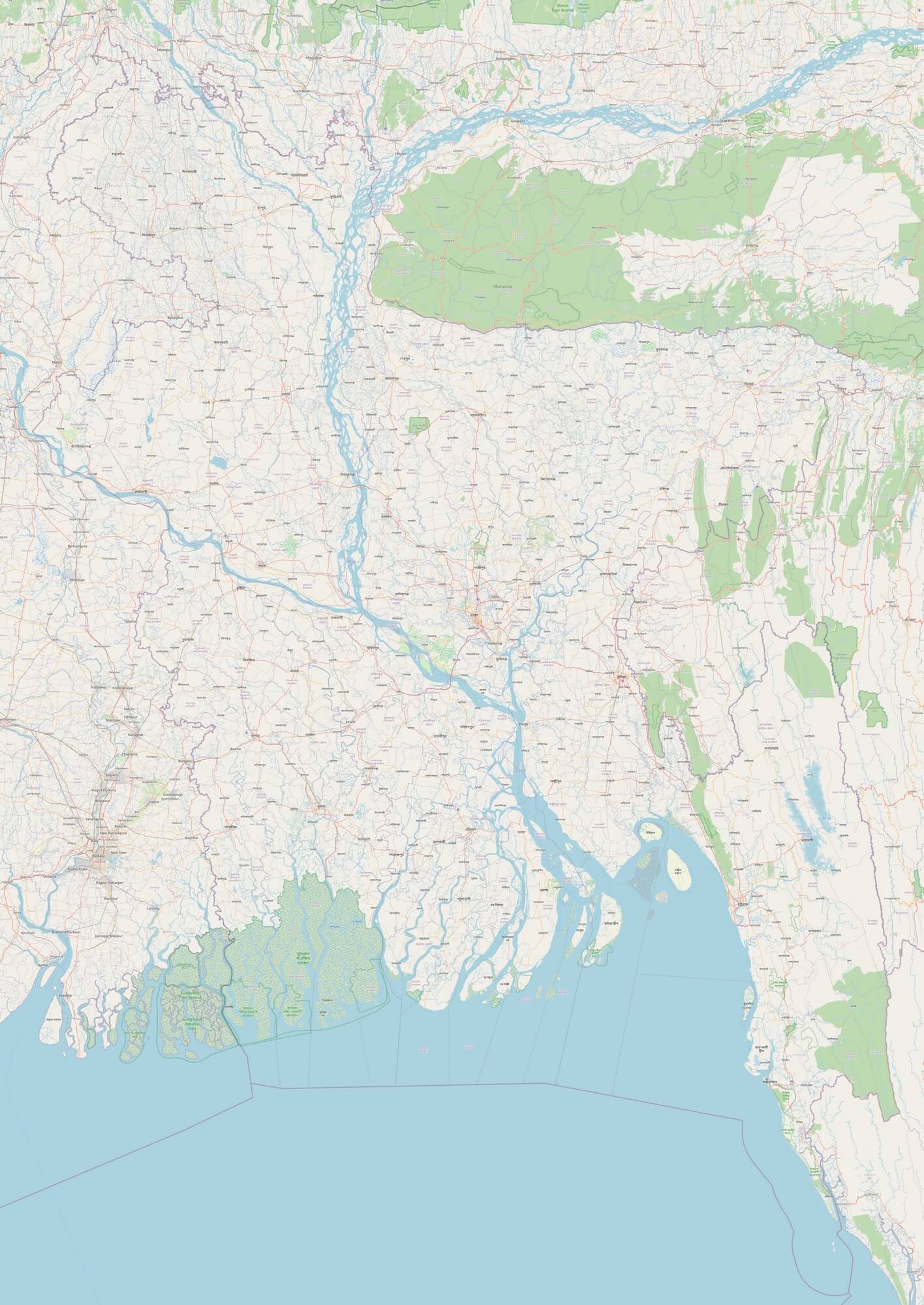
Detailed map of Bangladesh

Download: JPG (566 x 800 pixels) | JPG (1416 x 2000 pixels) | JPG (3500 x 4945 pixels) | PNG (566 x 800 pixels) | PNG (1416 x 2000 pixels) | PNG (3500 x 4945 pixels) | PDF
Description: Large detailed map of Bangladesh with cities, towns, main and secondary roads, rivers, mangroves and forests.
License: Open data (ODbl)
Author: OpenStreetMap and contributors
Source file: OpenStreetMap
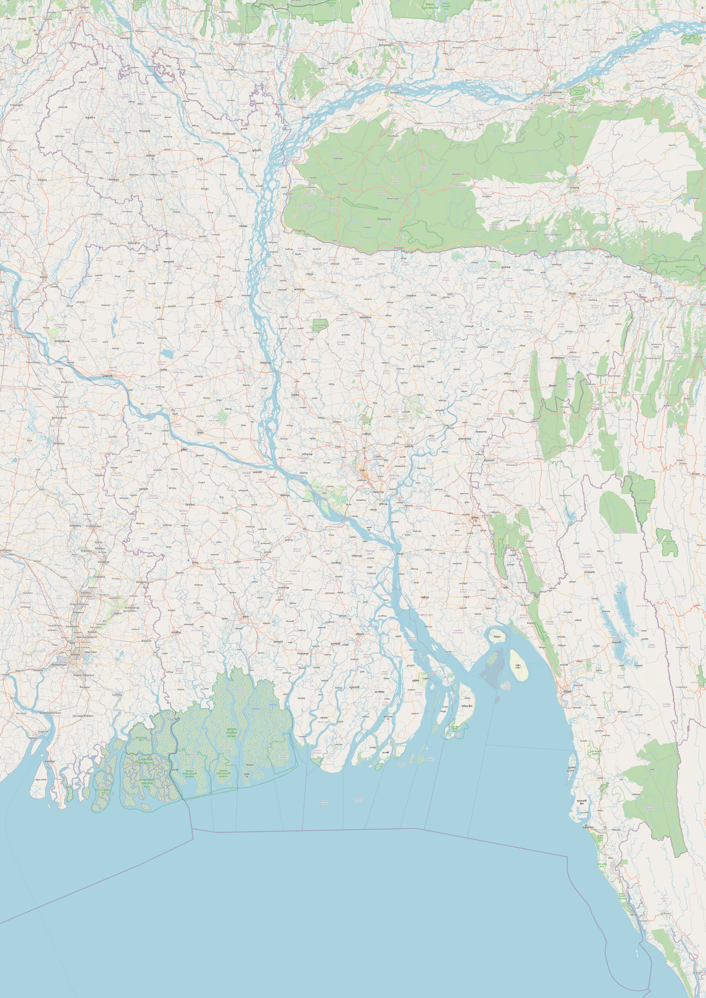
Description: Large detailed map of Bangladesh with cities, towns, main and secondary roads, rivers, mangroves and forests.
License: Open data (ODbl)
Author: OpenStreetMap and contributors
Source file: OpenStreetMap