WorldmapPDF
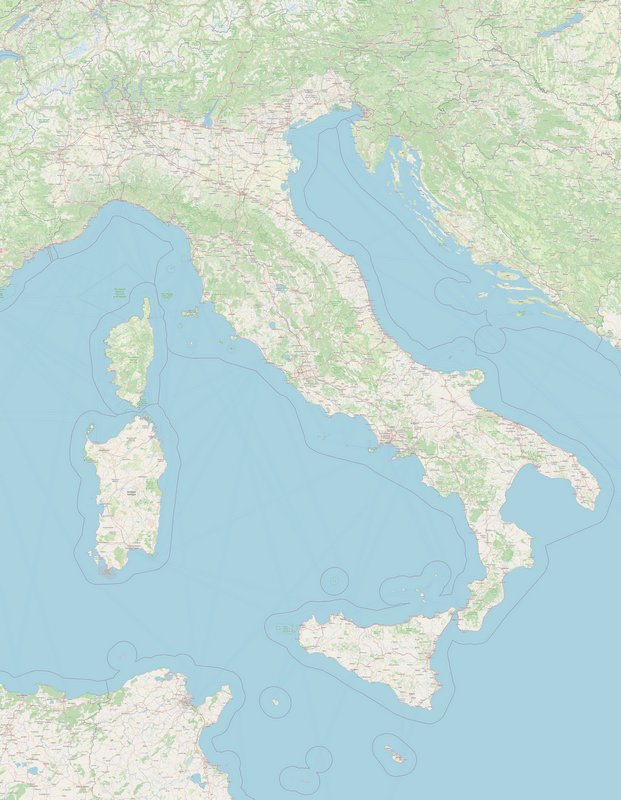
Large map of Italy with cities and roads
View detailed maps of Italy in HD and in different formats such as JPG, PDF, PNG. Maps in PNG format are often of better quality.


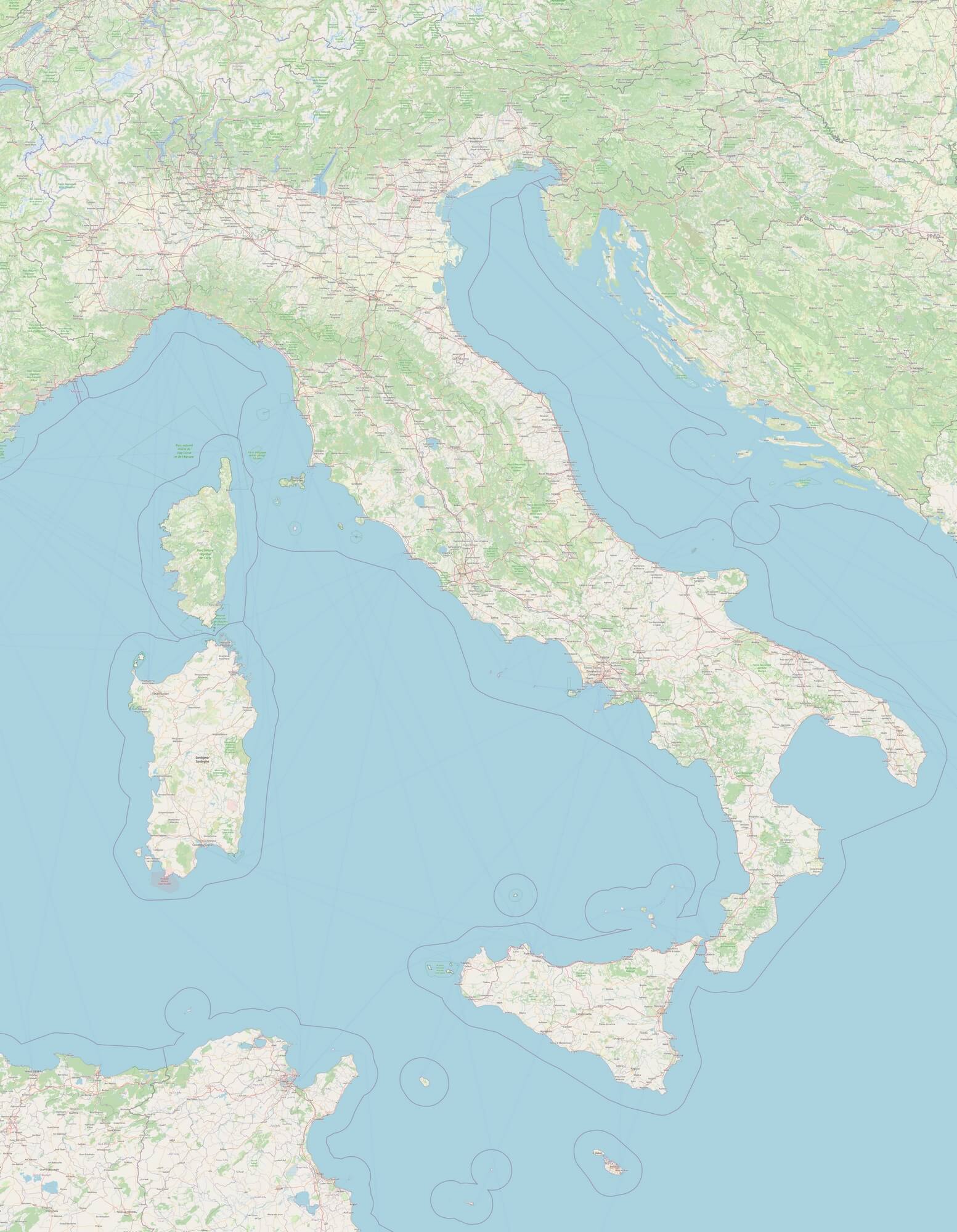
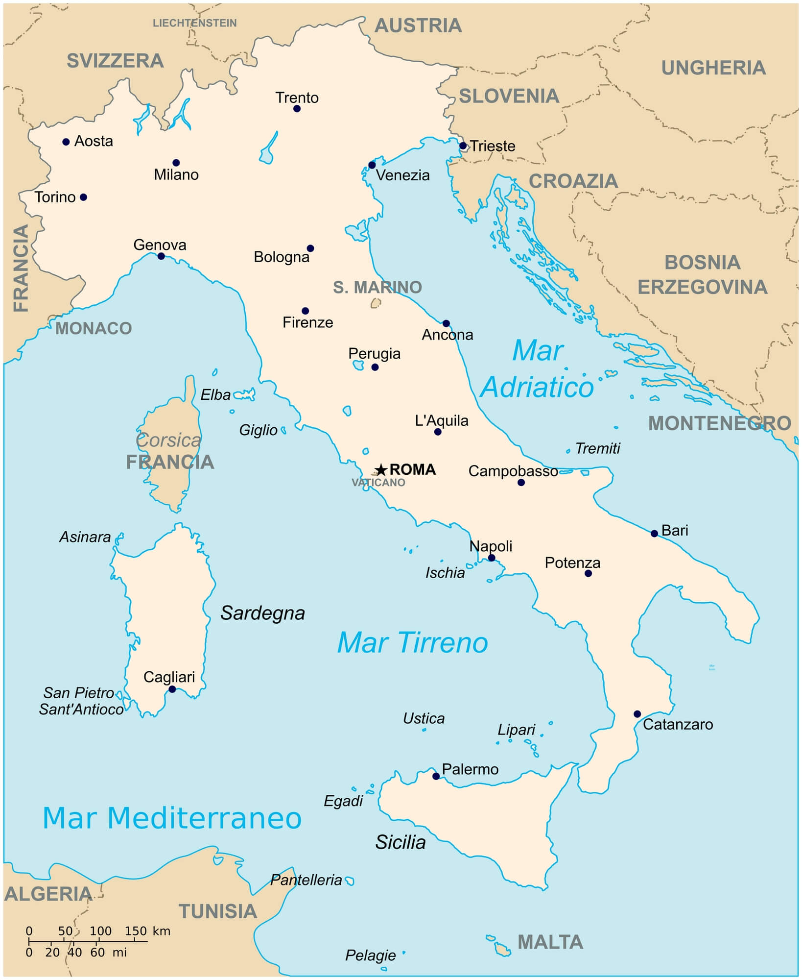
Detailed map of Italy

Download: JPG (621 x 800 pixels) | JPG (1553 x 2000 pixels) | JPG (3840 x 4945 pixels) | PNG (621 x 800 pixels) | PNG (1553 x 2000 pixels) | PNG (3840 x 4945 pixels) | PDF
Description: Large detailed map of Italy with major cities, small towns, main and secondary roads, forests, rivers and lakes.
License: Open data (ODbl)
Author: OpenStreetMap and contributors
Source file: OpenStreetMap
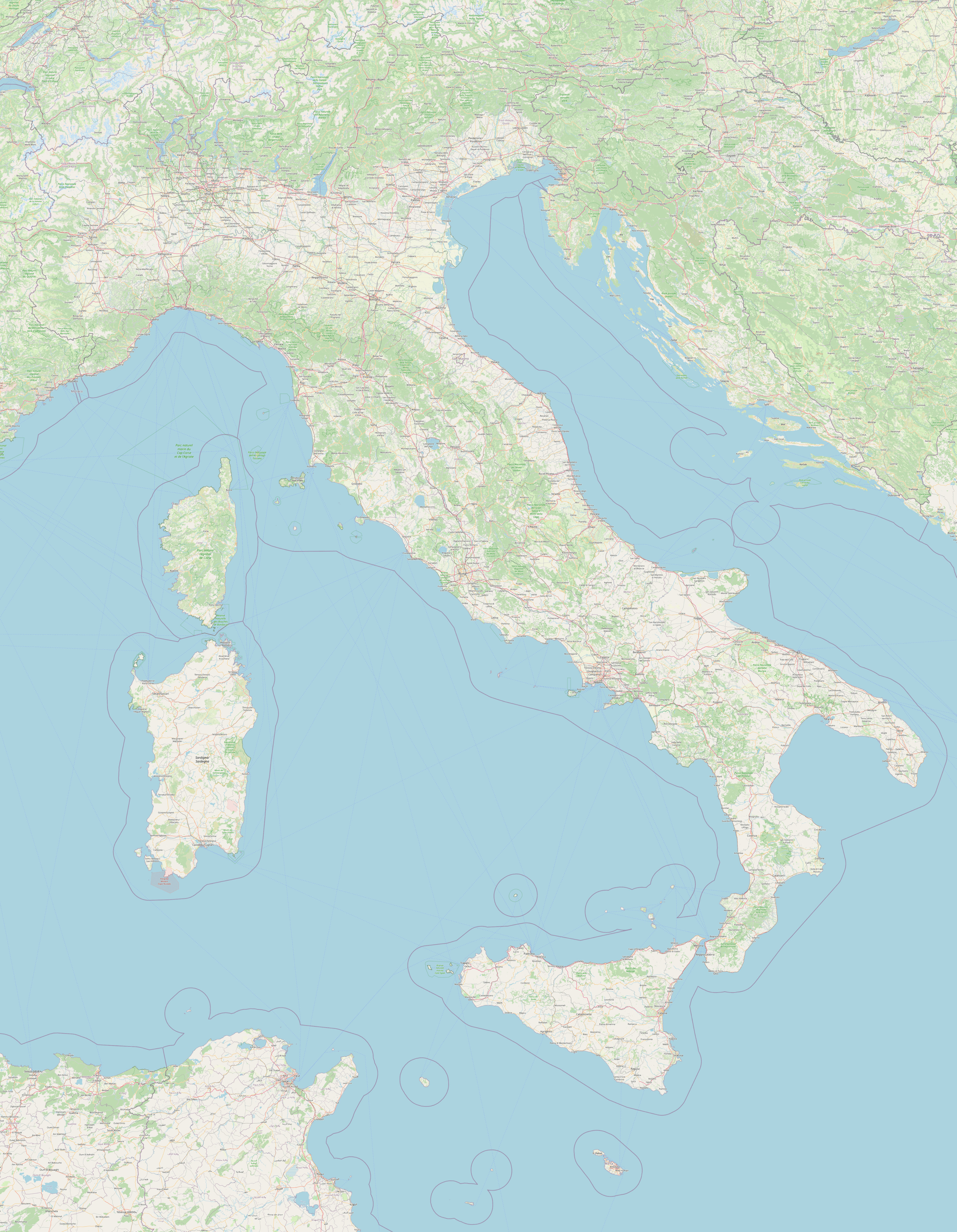
Description: Large detailed map of Italy with major cities, small towns, main and secondary roads, forests, rivers and lakes.
License: Open data (ODbl)
Author: OpenStreetMap and contributors
Source file: OpenStreetMap
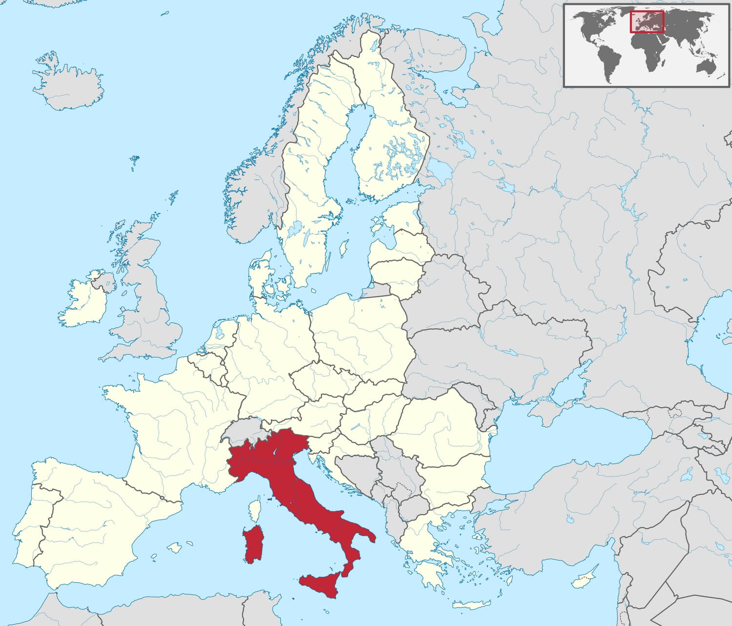
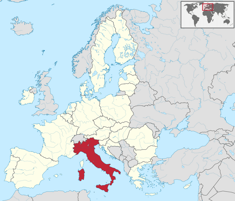
Italy location map

Download: JPG (800 x 684 pixels) | JPG (1500 x 1282 pixels) | JPG (2919 x 2495 pixels) | PNG (800 x 684 pixels) | PNG (1500 x 1282 pixels) | PNG (2919 x 2495 pixels) | PDF | SVG
Description: Map showing the location of Italy (in red) in the European Union (in white).
License: CC BY-SA 3.0
Author: TUBS
Source file: Wikimedia (view)
Description: Map showing the location of Italy (in red) in the European Union (in white).
License: CC BY-SA 3.0
Author: TUBS
Source file: Wikimedia (view)
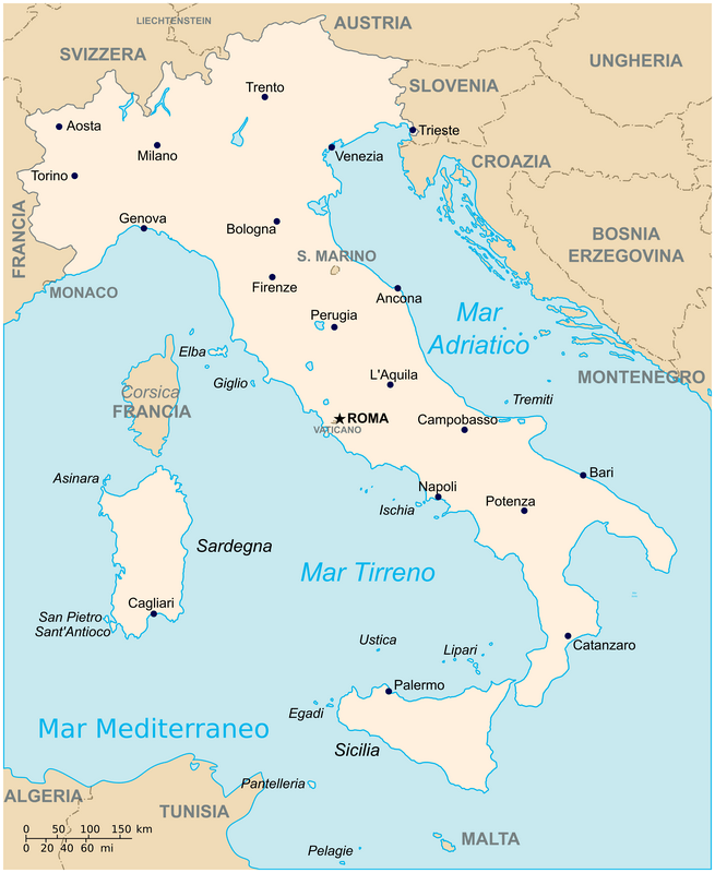
Simple map of Italy

Download: JPG (655 x 800 pixels) | JPG (1638 x 2000 pixels) | JPG (5116 x 6248 pixels) | PNG (655 x 800 pixels) | PNG (1638 x 2000 pixels) | PNG (5116 x 6248 pixels) | PDF | SVG
Description: Simple map of Italy with main cities, capital and bordering countries.
License: CC BY-SA 3.0
Author: Flanker and Krysis
Source file: Wikipedia (view)
Description: Simple map of Italy with main cities, capital and bordering countries.
License: CC BY-SA 3.0
Author: Flanker and Krysis
Source file: Wikipedia (view)