WorldmapPDF
Map of Spain with cities and islands
View detailed maps of Spain in HD and in different formats such as JPG, PDF, PNG. Maps in PNG format are often of better quality.


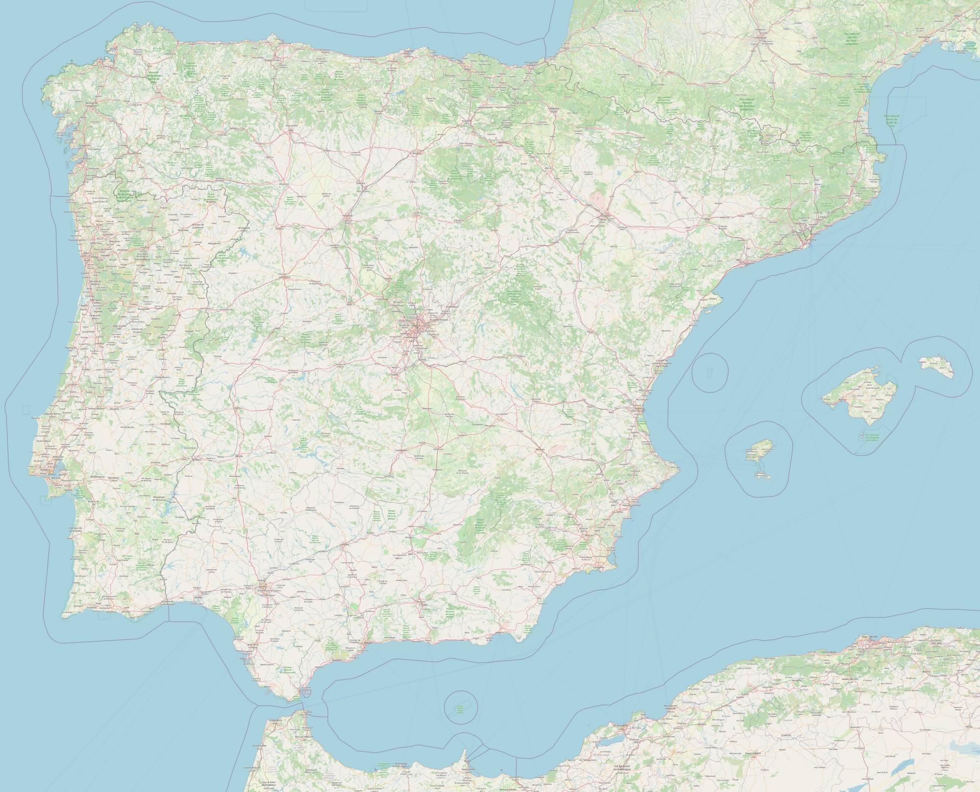
Detailed map of Spain with cities

Download: JPG (800 x 647 pixels) | JPG (2000 x 1617 pixels) | JPG (6118 x 4945 pixels) | PNG (800 x 647 pixels) | PNG (2000 x 1617 pixels) | PNG (6118 x 4945 pixels) | PDF
Description: Large detailed map of Spain with cities, towns, secondary and main roads, rivers, forests and islands.
License: Open data (ODbl)
Author: OpenStreetMap and contributors
Source file: OpenStreetMap
Description: Large detailed map of Spain with cities, towns, secondary and main roads, rivers, forests and islands.
License: Open data (ODbl)
Author: OpenStreetMap and contributors
Source file: OpenStreetMap
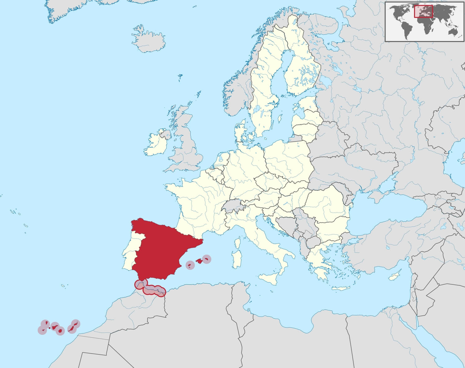
Spain location map

Download: JPG (800 x 633 pixels) | JPG (1500 x 1187 pixels) | JPG (2917 x 2308 pixels) | PNG (800 x 633 pixels) | PNG (1500 x 1187 pixels) | PNG (2917 x 2308 pixels) | PDF | SVG
Description: Map of Spain's location in Europe with the Canary Islands, the Balearic Islands and the Moroccan enclaves.
License: CC BY-SA 3.0
Author: TUBS
Source file: Wikimedia.org (view)
Description: Map of Spain's location in Europe with the Canary Islands, the Balearic Islands and the Moroccan enclaves.
License: CC BY-SA 3.0
Author: TUBS
Source file: Wikimedia.org (view)
_(special_marker).svg)
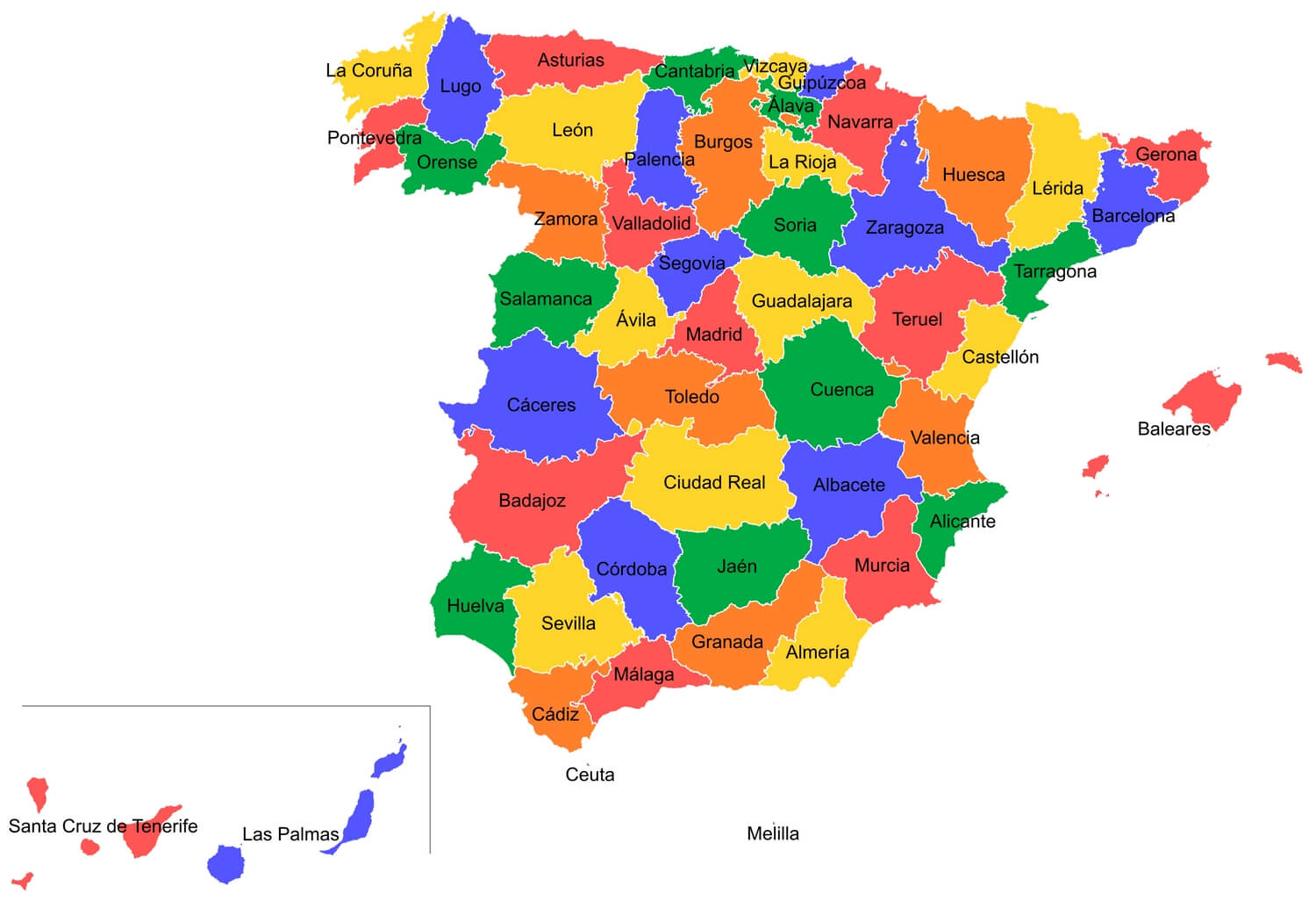
Map of Spain with provinces

Download: JPG (800 x 547 pixels) | JPG (1500 x 1026 pixels) | JPG (2922 x 1999 pixels) | PNG (800 x 547 pixels) | PNG (1500 x 1026 pixels) | PNG (2922 x 1999 pixels) | PDF | SVG
Description: Map of Spain with the provinces in color. The map also shows the Canary Islands and the Balearic Islands.
License: CC BY-SA 4.0
Author: Emilio Gómez Fernández & Javi C. S.
Source file: Wikimedia.org (view)
Description: Map of Spain with the provinces in color. The map also shows the Canary Islands and the Balearic Islands.
License: CC BY-SA 4.0
Author: Emilio Gómez Fernández & Javi C. S.
Source file: Wikimedia.org (view)