WorldmapPDF
Map of Indonesia with islands
View detailed maps of Indonesia in HD and in different formats such as JPG, PDF, PNG. Maps in PNG format are often of better quality.


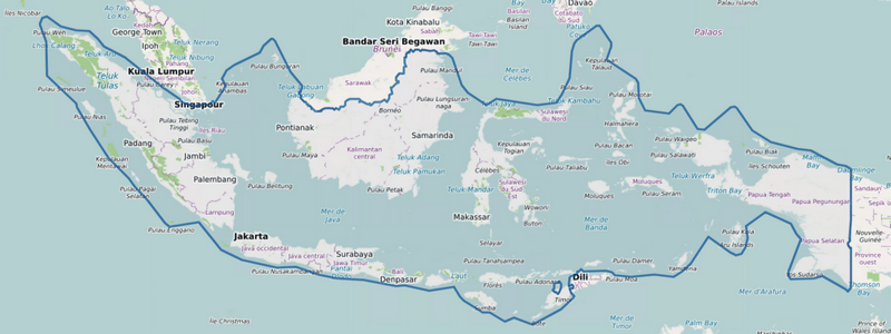
Large detailed map of Indonesia

Download: JPG (800 x 333 pixels) | JPG (2500 x 1042 pixels) | JPG (10039 x 4184 pixels) | PNG (800 x 333 pixels) | PNG (2500 x 1042 pixels) | PNG (10039 x 4184 pixels) | PDF
Description: Large, detailed map of Indonesia with roads, cities, towns, forests, rivers, lakes, and islands. The map also shows shipping routes that connect ports.
License: Open data (ODbl)
Author: OpenStreetMap and contributors
Source file: OpenStreetMap
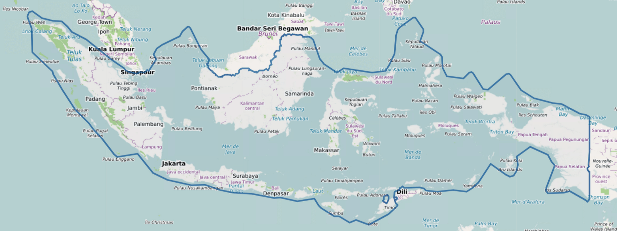
Description: Large, detailed map of Indonesia with roads, cities, towns, forests, rivers, lakes, and islands. The map also shows shipping routes that connect ports.
License: Open data (ODbl)
Author: OpenStreetMap and contributors
Source file: OpenStreetMap
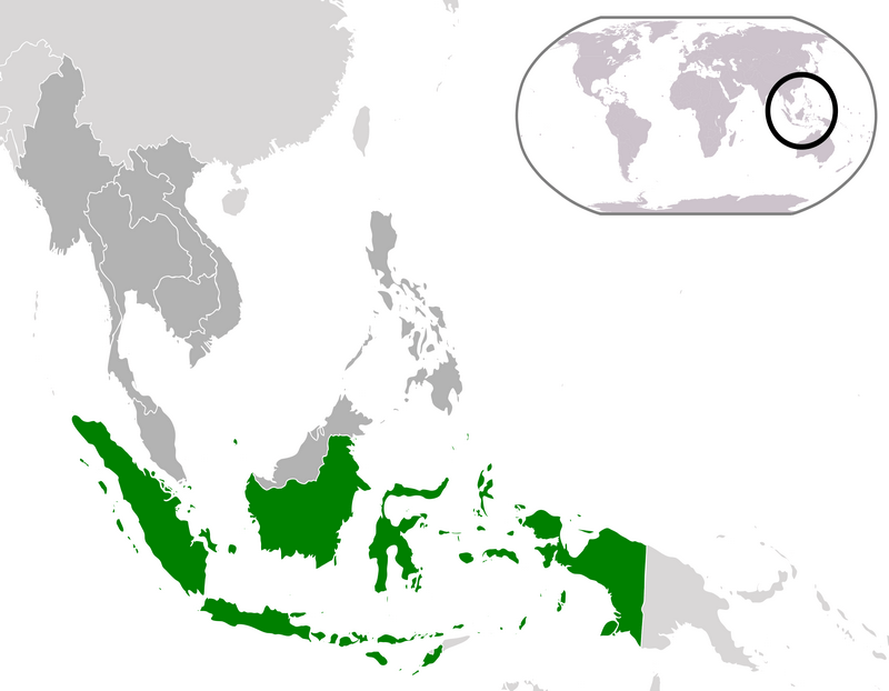
Indonesia location map

Download: JPG (800 x 622 pixels) | JPG (3240 x 2520 pixels) | PNG (800 x 622 pixels) | PNG (3240 x 2520 pixels) | PDF | SVG
Description: Map of Indonesia's location (in green) in the ASEAN region (in dark gray) in the world (in light gray).
License: Public domain
Author: ASDFGHJ
Source file: Wikimedia.org (view)
Description: Map of Indonesia's location (in green) in the ASEAN region (in dark gray) in the world (in light gray).
License: Public domain
Author: ASDFGHJ
Source file: Wikimedia.org (view)
Simple map of Indonesia
